Espalion geodata
Espalion (Occitanie) is a populated place; located in France in Europe/Paris (GMT+2) time zone. With population of 4,652 people, there are 2126 cities with bigger population in this country. Compared to other cities in France, 83.4% of cities are located further ↑North; 54.4% of cities are located further ←West and 84.4% of cities have lower elevation than Espalion. Note1
Administrative division(s):
- Level 1: Occitanie
- Level 2: Département de l'Aveyron
- Level 3: Arrondissement de Rodez
- Level 4: Espalion


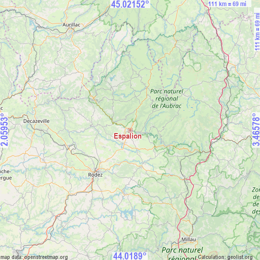
Espalion GPS coordinates[2]
44° 31' 20.532" North, 2° 45' 45.54" East
| Map corner | latitude | longitude |
|---|---|---|
| Upper-left | 45.02152°, | 2.05953° |
| Center: | 44.52237°, | 2.76265° |
| Lower-right: | 44.0189°, | 3.46578° |
| Map W x H: | 111.5×111.5 km | = 69.3×69.3mi |
| max Lat: | 51.07786° ⇑83.4% North |
| Espalion: | 44.52237° |
| min Lat: | ⇓16.6% South 41.3874° |
| min Long | Espalion | max Long |
| -5.08615° | 2.76265° | 9.52242° |
| W 54.4%⇐ | ⇒45.6% E |
Elevation
Elevation of Espalion is 340 m = 1115 ft, and this is 146.3 m = 480 ft above average elevation for this country.
| Max E: |
2333 m = 7654 ft | 15.6% |
| Espalion | 340 m 1115 ft | |
| Avg. | 193.7 m = 635 ft | |
Min E: |
-1 m = -3 ft | 84.4% |
See also: France elevation on elevation.city.
Geographical zone
Espalion is located in North temperate zone (between Tropic of Cancer and the Arctic Circle). Distance of this Northern Tropic circle is 2344.5 km =1456.8 mi to South.| Distance of | km | miles | from Espalion |
|---|---|---|---|
| North Pole | 5056.6 | 3142 | to North |
| Arctic Circle | 2450.8 | 1522.9 | to North |
| Tropic Cancer | 2344.5 | 1456.8 | to South |
| Equator | 4950.4 | 3076 | to South |


Nearby cities:
15 places around Espalion: (largest is in red/bold)
• Bertholène
14.2 km =8.8 mi,  174°
174°
• Bozouls
6.5 km =4 mi,  207°
207°
• Castelnau-de-Mandailles
9.9 km =6.2 mi,  78°
78°
• Coubisou
4.3 km =2.7 mi,  321°
321°
• Entraygues-sur-Truyère
20.7 km =12.9 mi,  311°
311°
• Estaing
8.1 km =5 mi,  296°
296°
• La Loubière
18.4 km =11.4 mi,  204°
204°
• Laguiole
19.2 km =11.9 mi,  20°
20°
• Laissac
16.4 km =10.2 mi,  163°
163°
• Le Nayrac
12.8 km =8 mi, 322°
• Montpeyroux
14.2 km =8.8 mi, 20°
• Rodelle
11.6 km =7.2 mi,  252°
252°
• Saint-Amans-des-Cots
19.9 km =12.4 mi,  336°
336°
• Saint-Geniez-d’Olt
17.8 km =11.1 mi,  110°
110°
• Sébazac-Concourès
18.2 km =11.3 mi,  224°
224°
Sources, notices
• [Note1] Compared only with cities in France existing in our database
• [Src1] Map data: © OpenStreetMap contributors (CC-BY-SA)
• [Src2] Other city data from geonames.org with taken over terms of usage.
• [Src3] Geographical zone / Annual Mean Temperature by Robert A. Rohde @ Wikipedia
