Bouttencourt geodata
Bouttencourt (Hauts-de-France) is a populated place; located in France in Europe/Paris (GMT+2) time zone. With population of 1,036 people, there are 8567 cities with bigger population in this country. Compared to other cities in France, 93.2% of cities are located further ↓South; 61.2% of cities are located further →East and 71.9% of cities have higher elevation than Bouttencourt. Note1
Administrative division(s):
- Level 1: Hauts-de-France
- Level 2: Somme
- Level 3: Abbeville
- Level 4: Bouttencourt


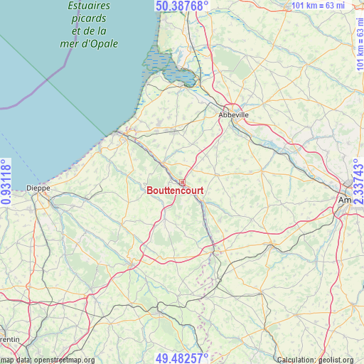
Bouttencourt GPS coordinates[2]
49° 56' 14.1" North, 1° 38' 3.516" East
| Map corner | latitude | longitude |
|---|---|---|
| Upper-left | 50.38768°, | 0.93118° |
| Center: | 49.93725°, | 1.63431° |
| Lower-right: | 49.48257°, | 2.33743° |
| Map W x H: | 100.6×100.6 km | = 62.5×62.5mi |
| max Lat: | 51.07786° ⇑6.8% North |
| Bouttencourt: | 49.93725° |
| min Lat: | ⇓93.2% South 41.3874° |
| min Long | Bouttencourt | max Long |
| -5.08615° | 1.63431° | 9.52242° |
| W 38.8%⇐ | ⇒61.2% E |
Elevation
Elevation of Bouttencourt is 74 m = 243 ft, and this is 119.7 m = 393 ft below average elevation for this country.
| Max E: |
2333 m = 7654 ft | 71.9% |
| Avg. | 193.7 m = 635 ft | |
| Bouttencourt | 74 m = 243 ft | |
Min E: |
-1 m = -3 ft | 28.1% |
See also: France elevation on elevation.city.
Geographical zone
Bouttencourt is located in North temperate zone (between Tropic of Cancer and the Arctic Circle). Distance of this North polar circle is 1848.7 km =1148.7 mi to North.| Distance of | km | miles | from Bouttencourt |
|---|---|---|---|
| North Pole | 4454.6 | 2768 | to North |
| Arctic Circle | 1848.7 | 1148.7 | to North |
| Tropic Cancer | 2946.6 | 1830.9 | to South |
| Equator | 5552.5 | 3450.2 | to South |


Nearby cities:
15 places around Bouttencourt: (largest is in red/bold)
• Aigneville
10.9 km =6.8 mi,  354°
354°
• Beauchamps
11.8 km =7.3 mi,  314°
314°
• Blangy-sur-Bresle
0.9 km =0.6 mi,  228°
228°
• Embreville
12.1 km =7.5 mi,  326°
326°
• Foucarmont
11.1 km =6.9 mi,  204°
204°
• Gamaches
7.8 km =4.8 mi, 314°
• Incheville
13 km =8.1 mi, 309°
• Longroy
8.8 km =5.5 mi, 310°
• Maisnières
8.7 km =5.4 mi, 352°
• Monchaux-Soreng
3.2 km =2 mi,  295°
295°
• Oisemont
9.7 km =6 mi,  77°
77°
• Rieux
3.7 km =2.3 mi,  267°
267°
• Senarpont
8.2 km =5.1 mi,  131°
131°
• Tours-en-Vimeu
11.5 km =7.1 mi,  18°
18°
• Vieux-Rouen-sur-Bresle
13 km =8.1 mi,  151°
151°
Sources, notices
• [Note1] Compared only with cities in France existing in our database
• [Src1] Map data: © OpenStreetMap contributors (CC-BY-SA)
• [Src2] Other city data from geonames.org with taken over terms of usage.
• [Src3] Geographical zone / Annual Mean Temperature by Robert A. Rohde @ Wikipedia
