Bourbriac geodata
Bourbriac (Brittany) is a populated place; located in France in Europe/Paris (GMT+2) time zone. With population of 2,349 people, there are 4109 cities with bigger population in this country. Compared to other cities in France, 67.7% of cities are located further ↓South; 97.7% of cities are located further →East and 68% of cities have lower elevation than Bourbriac. Note1
Administrative division(s):
- Level 1: Brittany
- Level 2: Département des Côtes-d’Armor
- Level 3: Arrondissement de Guingamp
- Level 4: Bourbriac


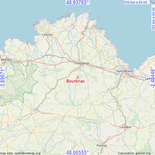
Bourbriac GPS coordinates[2]
48° 28' 25.824" North, 3° 11' 15.288" West
| Map corner | latitude | longitude |
|---|---|---|
| Upper-left | 48.93785°, | -3.89071° |
| Center: | 48.47384°, | -3.18758° |
| Lower-right: | 48.00555°, | -2.48446° |
| Map W x H: | 103.7×103.7 km | = 64.4×64.4mi |
| max Lat: | 51.07786° ⇑32.3% North |
| Bourbriac: | 48.47384° |
| min Lat: | ⇓67.7% South 41.3874° |
| min Long | Bourbriac | max Long |
| -5.08615° | -3.18758° | 9.52242° |
| W 2.3%⇐ | ⇒97.7% E |
Elevation
Elevation of Bourbriac is 209 m = 686 ft, and this is 15.3 m = 50 ft above average elevation for this country.
| Max E: |
2333 m = 7654 ft | 32% |
| Bourbriac | 209 m 686 ft | |
| Avg. | 193.7 m = 635 ft | |
Min E: |
-1 m = -3 ft | 68% |
See also: France elevation on elevation.city.
Geographical zone
Bourbriac is located in North temperate zone (between Tropic of Cancer and the Arctic Circle). Distance of this North polar circle is 2011.4 km =1249.8 mi to North.| Distance of | km | miles | from Bourbriac |
|---|---|---|---|
| North Pole | 4617.3 | 2869.1 | to North |
| Arctic Circle | 2011.4 | 1249.8 | to North |
| Tropic Cancer | 2783.9 | 1729.8 | to South |
| Equator | 5389.8 | 3349.1 | to South |


Nearby cities:
15 places around Bourbriac: (largest is in red/bold)
• Coadout
4.8 km =3 mi,  0°
0°
• Grâces
9.2 km =5.7 mi, 1°
• Guingamp
10.2 km =6.3 mi,  15°
15°
• Lanrivain
14.3 km =8.9 mi,  187°
187°
• Lanrodec
12.4 km =7.7 mi,  67°
67°
• Le Merzer
14.3 km =8.9 mi,  37°
37°
• Moustéru
6.2 km =3.9 mi,  321°
321°
• Pabu
13 km =8.1 mi, 16°
• Plougonver
14.1 km =8.8 mi,  274°
274°
• Plouisy
11.6 km =7.2 mi, 1°
• Ploumagoar
8.9 km =5.5 mi,  27°
27°
• Plésidy
5.8 km =3.6 mi,  120°
120°
• Pont-Melvez
8.9 km =5.5 mi,  260°
260°
• Saint-Agathon
11.2 km =7 mi, 32°
• Tréglamus
11.3 km =7 mi,  325°
325°
Sources, notices
• [Note1] Compared only with cities in France existing in our database
• [Src1] Map data: © OpenStreetMap contributors (CC-BY-SA)
• [Src2] Other city data from geonames.org with taken over terms of usage.
• [Src3] Geographical zone / Annual Mean Temperature by Robert A. Rohde @ Wikipedia
