Bouleternère geodata
Bouleternère (Occitanie) is a populated place; located in France in Europe/Paris (GMT+2) time zone. With population of 704 people, there are 11748 cities with bigger population in this country. Compared to other cities in France, 99.1% of cities are located further ↑North; 51.9% of cities are located further ←West and 65% of cities have lower elevation than Bouleternère. Note1
Administrative division(s):
- Level 1: Occitanie
- Level 2: Département des Pyrénées-Orientales
- Level 3: Arrondissement de Prades
- Level 4: Bouleternère


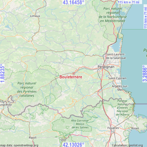
Bouleternère GPS coordinates[2]
42° 38' 58.452" North, 2° 35' 7.728" East
| Map corner | latitude | longitude |
|---|---|---|
| Upper-left | 43.16458°, | 1.88235° |
| Center: | 42.64957°, | 2.58548° |
| Lower-right: | 42.13026°, | 3.2886° |
| Map W x H: | 115×115 km | = 71.5×71.5mi |
| max Lat: | 51.07786° ⇑99.1% North |
| Bouleternère: | 42.64957° |
| min Lat: | ⇓0.9% South 41.3874° |
| min Long | Bouleternère | max Long |
| -5.08615° | 2.58548° | 9.52242° |
| W 51.9%⇐ | ⇒48.1% E |
Elevation
Elevation of Bouleternère is 194 m = 636 ft, and this is 0.30000000000001 m = 1 ft above average elevation for this country.
| Max E: |
2333 m = 7654 ft | 35% |
| Bouleternère | 194 m 636 ft | |
| Avg. | 193.7 m = 635 ft | |
Min E: |
-1 m = -3 ft | 65% |
See also: France elevation on elevation.city.
Geographical zone
Bouleternère is located in North temperate zone (between Tropic of Cancer and the Arctic Circle). Distance of this Northern Tropic circle is 2136.3 km =1327.4 mi to South.| Distance of | km | miles | from Bouleternère |
|---|---|---|---|
| North Pole | 5264.9 | 3271.5 | to North |
| Arctic Circle | 2659 | 1652.2 | to North |
| Tropic Cancer | 2136.3 | 1327.4 | to South |
| Equator | 4742.2 | 2946.7 | to South |


Nearby cities:
15 places around Bouleternère: (largest is in red/bold)
• Catllar
13.5 km =8.4 mi,  262°
262°
• Corbère
6.2 km =3.9 mi,  86°
86°
• Corbère-les-Cabanes
7.3 km =4.5 mi,  82°
82°
• Corneilla-la-Rivière
12.9 km =8 mi,  66°
66°
• Ille-sur-Têt
3.8 km =2.4 mi,  51°
51°
• Los Masos
11.2 km =7 mi, 260°
• Marquixanes
8.4 km =5.2 mi, 263°
• Millas
10.1 km =6.3 mi,  62°
62°
• Néfiach
8.3 km =5.2 mi, 53°
• Prades
13.8 km =8.6 mi,  254°
254°
• Rodès
2.1 km =1.3 mi,  292°
292°
• Saint-Féliu-d’Amont
12 km =7.5 mi, 69°
• Saint-Féliu-d’Avall
13 km =8.1 mi, 74°
• Thuir
14 km =8.7 mi,  97°
97°
• Vinça
4.7 km =2.9 mi, 263°
Sources, notices
• [Note1] Compared only with cities in France existing in our database
• [Src1] Map data: © OpenStreetMap contributors (CC-BY-SA)
• [Src2] Other city data from geonames.org with taken over terms of usage.
• [Src3] Geographical zone / Annual Mean Temperature by Robert A. Rohde @ Wikipedia
