Blennes geodata
Blennes (Île-de-France) is a populated place; located in France in Europe/Paris (GMT+2) time zone. With population of 526 people, there are 14691 cities with bigger population in this country. Compared to other cities in France, 63.8% of cities are located further ↓South; 58.2% of cities are located further ←West and 57.3% of cities have higher elevation than Blennes. Note1
Administrative division(s):
- Level 1: Île-de-France
- Level 2: Seine-et-Marne
- Level 3: Arrondissement de Provins
- Level 4: Blennes


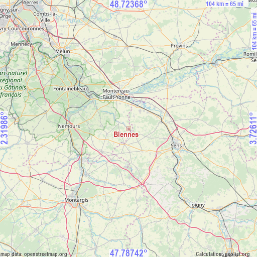
Blennes GPS coordinates[2]
48° 15' 27.684" North, 3° 1' 22.764" East
| Map corner | latitude | longitude |
|---|---|---|
| Upper-left | 48.72368°, | 2.31986° |
| Center: | 48.25769°, | 3.02299° |
| Lower-right: | 47.78742°, | 3.72611° |
| Map W x H: | 104.1×104.1 km | = 64.7×64.7mi |
| max Lat: | 51.07786° ⇑36.2% North |
| Blennes: | 48.25769° |
| min Lat: | ⇓63.8% South 41.3874° |
| min Long | Blennes | max Long |
| -5.08615° | 3.02299° | 9.52242° |
| W 58.2%⇐ | ⇒41.8% E |
Elevation
Elevation of Blennes is 110 m = 361 ft, and this is 83.7 m = 275 ft below average elevation for this country.
| Max E: |
2333 m = 7654 ft | 57.3% |
| Avg. | 193.7 m = 635 ft | |
| Blennes | 110 m = 361 ft | |
Min E: |
-1 m = -3 ft | 42.7% |
See also: France elevation on elevation.city.
Geographical zone
Blennes is located in North temperate zone (between Tropic of Cancer and the Arctic Circle). Distance of this North polar circle is 2035.4 km =1264.7 mi to North.| Distance of | km | miles | from Blennes |
|---|---|---|---|
| North Pole | 4641.3 | 2884 | to North |
| Arctic Circle | 2035.4 | 1264.7 | to North |
| Tropic Cancer | 2759.8 | 1714.9 | to South |
| Equator | 5365.8 | 3334.2 | to South |


Nearby cities:
15 places around Blennes: (largest is in red/bold)
• Brannay
7.6 km =4.7 mi,  113°
113°
• Champigny
10.5 km =6.5 mi,  51°
51°
• Chaumont
9.4 km =5.8 mi,  40°
40°
• Chéroy
6.6 km =4.1 mi,  194°
194°
• Esmans
10.4 km =6.5 mi,  340°
340°
• Flagy
9.6 km =6 mi,  309°
309°
• La Brosse-Montceaux
9.7 km =6 mi,  358°
358°
• Lorrez-le-Bocage-Préaux
9.5 km =5.9 mi,  253°
253°
• Montacher-Villegardin
10.1 km =6.3 mi,  175°
175°
• Saint-Valérien
10.3 km =6.4 mi,  148°
148°
• Thoury-Férottes
7.3 km =4.5 mi,  303°
303°
• Villeblevin
8.6 km =5.3 mi,  29°
29°
• Villeneuve-la-Guyard
9.7 km =6 mi,  17°
17°
• Villethierry
3.8 km =2.4 mi,  80°
80°
• Voulx
4.9 km =3 mi, 303°
Sources, notices
• [Note1] Compared only with cities in France existing in our database
• [Src1] Map data: © OpenStreetMap contributors (CC-BY-SA)
• [Src2] Other city data from geonames.org with taken over terms of usage.
• [Src3] Geographical zone / Annual Mean Temperature by Robert A. Rohde @ Wikipedia
