Berthelming geodata
Berthelming (Grand Est) is a populated place; located in France in Europe/Paris (GMT+2) time zone. With population of 535 people, there are 14511 cities with bigger population in this country. Compared to other cities in France, 75.9% of cities are located further ↓South; 94.9% of cities are located further ←West and 73% of cities have lower elevation than Berthelming. Note1
Administrative division(s):
- Level 1: Grand Est
- Level 2: Moselle
- Level 3: Arrondissement de Sarrebourg-Château-Salins
- Level 4: Berthelming


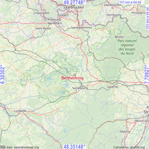
Berthelming GPS coordinates[2]
48° 48' 59.796" North, 7° 0' 22.14" East
| Map corner | latitude | longitude |
|---|---|---|
| Upper-left | 49.27746°, | 6.30302° |
| Center: | 48.81661°, | 7.00615° |
| Lower-right: | 48.35148°, | 7.70927° |
| Map W x H: | 103×103 km | = 64×64mi |
| max Lat: | 51.07786° ⇑24.1% North |
| Berthelming: | 48.81661° |
| min Lat: | ⇓75.9% South 41.3874° |
| min Long | Berthelming | max Long |
| -5.08615° | 7.00615° | 9.52242° |
| W 94.9%⇐ | ⇒5.1% E |
Elevation
Elevation of Berthelming is 236 m = 774 ft, and this is 42.3 m = 139 ft above average elevation for this country.
| Max E: |
2333 m = 7654 ft | 27% |
| Berthelming | 236 m 774 ft | |
| Avg. | 193.7 m = 635 ft | |
Min E: |
-1 m = -3 ft | 73% |
See also: France elevation on elevation.city.
Geographical zone
Berthelming is located in North temperate zone (between Tropic of Cancer and the Arctic Circle). Distance of this North polar circle is 1973.3 km =1226.2 mi to North.| Distance of | km | miles | from Berthelming |
|---|---|---|---|
| North Pole | 4579.2 | 2845.4 | to North |
| Arctic Circle | 1973.3 | 1226.2 | to North |
| Tropic Cancer | 2822 | 1753.5 | to South |
| Equator | 5427.9 | 3372.7 | to South |


Nearby cities:
15 places around Berthelming: (largest is in red/bold)
• Fénétrange
3.6 km =2.2 mi,  20°
20°
• Gosselming
2.8 km =1.7 mi,  186°
186°
• Harskirchen
13.2 km =8.2 mi,  9°
9°
• Hesse
14 km =8.7 mi,  167°
167°
• Hilbesheim
8.1 km =5 mi,  123°
123°
• Hommarting
13.3 km =8.3 mi,  130°
130°
• Imling
10.9 km =6.8 mi, 173°
• Lixheim
10.9 km =6.8 mi,  114°
114°
• Mittersheim
6.8 km =4.2 mi,  316°
316°
• Niderviller
13.7 km =8.5 mi,  147°
147°
• Réding
10.3 km =6.4 mi, 134°
• Sarraltroff
6 km =3.7 mi,  138°
138°
• Sarrebourg
9.8 km =6.1 mi,  157°
157°
• Sarrewerden
13.1 km =8.1 mi,  25°
25°
• Weyer
12 km =7.5 mi,  69°
69°
Sources, notices
• [Note1] Compared only with cities in France existing in our database
• [Src1] Map data: © OpenStreetMap contributors (CC-BY-SA)
• [Src2] Other city data from geonames.org with taken over terms of usage.
• [Src3] Geographical zone / Annual Mean Temperature by Robert A. Rohde @ Wikipedia
