Mittersheim geodata
Mittersheim (Grand Est) is a populated place; located in France in Europe/Paris (GMT+2) time zone. With population of 554 people, there are 14131 cities with bigger population in this country. Compared to other cities in France, 76.8% of cities are located further ↓South; 94.5% of cities are located further ←West and 74% of cities have lower elevation than Mittersheim. Note1
Administrative division(s):
- Level 1: Grand Est
- Level 2: Moselle
- Level 3: Arrondissement de Sarrebourg-Château-Salins
- Level 4: Mittersheim


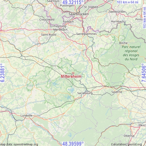
Mittersheim GPS coordinates[2]
48° 51' 38.556" North, 6° 56' 30.984" East
| Map corner | latitude | longitude |
|---|---|---|
| Upper-left | 49.32115°, | 6.23881° |
| Center: | 48.86071°, | 6.94194° |
| Lower-right: | 48.39599°, | 7.64506° |
| Map W x H: | 102.9×102.9 km | = 63.9×63.9mi |
| max Lat: | 51.07786° ⇑23.2% North |
| Mittersheim: | 48.86071° |
| min Lat: | ⇓76.8% South 41.3874° |
| min Long | Mittersheim | max Long |
| -5.08615° | 6.94194° | 9.52242° |
| W 94.5%⇐ | ⇒5.5% E |
Elevation
Elevation of Mittersheim is 242 m = 794 ft, and this is 48.3 m = 158 ft above average elevation for this country.
| Max E: |
2333 m = 7654 ft | 26% |
| Mittersheim | 242 m 794 ft | |
| Avg. | 193.7 m = 635 ft | |
Min E: |
-1 m = -3 ft | 74% |
See also: France elevation on elevation.city.
Geographical zone
Mittersheim is located in North temperate zone (between Tropic of Cancer and the Arctic Circle). Distance of this North polar circle is 1968.4 km =1223.1 mi to North.| Distance of | km | miles | from Mittersheim |
|---|---|---|---|
| North Pole | 4574.3 | 2842.3 | to North |
| Arctic Circle | 1968.4 | 1223.1 | to North |
| Tropic Cancer | 2826.9 | 1756.6 | to South |
| Equator | 5432.8 | 3375.8 | to South |


Nearby cities:
15 places around Mittersheim: (largest is in red/bold)
• Albestroff
10.2 km =6.3 mi,  321°
321°
• Berthelming
6.8 km =4.2 mi,  136°
136°
• Bénestroff
14.2 km =8.8 mi,  289°
289°
• Francaltroff
15.4 km =9.6 mi, 317°
• Fénétrange
6.1 km =3.8 mi,  104°
104°
• Gosselming
8.8 km =5.5 mi,  150°
150°
• Harskirchen
10.7 km =6.6 mi,  40°
40°
• Hilbesheim
14.8 km =9.2 mi,  129°
129°
• Insming
11.6 km =7.2 mi,  335°
335°
• Keskastel
14.4 km =8.9 mi,  31°
31°
• Le Val-de-Guéblange
13.5 km =8.4 mi,  6°
6°
• Sarraltroff
12.8 km =8 mi, 137°
• Sarre-Union
14 km =8.7 mi,  52°
52°
• Sarrewerden
12.5 km =7.8 mi,  56°
56°
• Vergaville
14.6 km =9.1 mi,  260°
260°
Sources, notices
• [Note1] Compared only with cities in France existing in our database
• [Src1] Map data: © OpenStreetMap contributors (CC-BY-SA)
• [Src2] Other city data from geonames.org with taken over terms of usage.
• [Src3] Geographical zone / Annual Mean Temperature by Robert A. Rohde @ Wikipedia
