Saint-Sauveur-de-Cruzières geodata
Saint-Sauveur-de-Cruzières (Auvergne-Rhône-Alpes) is a populated place; located in France in Europe/Paris (GMT+2) time zone. With population of 521 people, there are 14791 cities with bigger population in this country. Compared to other cities in France, 84.8% of cities are located further ↑North; 70.2% of cities are located further ←West and 55.3% of cities have lower elevation than Saint-Sauveur-de-Cruzières. Note1
Administrative division(s):
- Level 1: Auvergne-Rhône-Alpes
- Level 2: Département de l'Ardèche
- Level 3: Arrondissement de Largentière
- Level 4: Saint-Sauveur-de-Cruzières
Current local time in Saint-Sauveur-de-Cruzières:
05:21 PM, SaturdayDifference from your time zone: hours


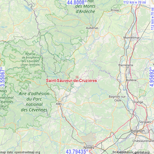
Saint-Sauveur-de-Cruzières GPS coordinates[2]
44° 17' 59.028" North, 4° 15' 13.644" East
| Map corner | latitude | longitude |
|---|---|---|
| Upper-left | 44.8008°, | 3.55067° |
| Center: | 44.29973°, | 4.25379° |
| Lower-right: | 43.79435°, | 4.95692° |
| Map W x H: | 111.9×111.9 km | = 69.5×69.5mi |
| max Lat: | 51.07786° ⇑84.8% North |
| Saint-Sauveur-de-Cruzières: | 44.29973° |
| min Lat: | ⇓15.2% South 41.3874° |
| min Long | Saint-Sauveur-d | max Long |
| -5.08615° | 4.25379° | 9.52242° |
| W 70.2%⇐ | ⇒29.8% E |
Elevation
Elevation of Saint-Sauveur-de-Cruzières is 151 m = 495 ft, and this is 42.7 m = 140 ft below average elevation for this country.
| Max E: |
2333 m = 7654 ft | 44.7% |
| Avg. | 193.7 m = 635 ft | |
| Saint-Sauveur-de-Cruzières | 151 m = 495 ft | |
Min E: |
-1 m = -3 ft | 55.3% |
See also: France elevation on elevation.city.
Geographical zone
Saint-Sauveur-de-Cruzières is located in North temperate zone (between Tropic of Cancer and the Arctic Circle). Distance of this Northern Tropic circle is 2319.7 km =1441.4 mi to South.| Distance of | km | miles | from Saint-Sauveur-de-Cruzières |
|---|---|---|---|
| North Pole | 5081.4 | 3157.4 | to North |
| Arctic Circle | 2475.5 | 1538.2 | to North |
| Tropic Cancer | 2319.7 | 1441.4 | to South |
| Equator | 4925.7 | 3060.7 | to South |


Nearby cities:
15 places around Saint-Sauveur-de-Cruzières: (largest is in red/bold)
• Allègre-les-Fumades
11.1 km =6.9 mi,  183°
183°
• Banne
10.8 km =6.7 mi,  313°
313°
• Barjac
7.8 km =4.8 mi,  83°
83°
• Berrias-et-Casteljau
8.6 km =5.3 mi,  330°
330°
• Gagnières
10 km =6.2 mi,  274°
274°
• Les Mages
10.4 km =6.5 mi,  220°
220°
• Meyrannes
7.5 km =4.7 mi,  244°
244°
• Molières-sur-Cèze
8.8 km =5.5 mi, 239°
• Robiac-Rochessadoule
10.3 km =6.4 mi,  249°
249°
• Saint-Ambroix
6.3 km =3.9 mi, 224°
• Saint-André-de-Cruzières
3.4 km =2.1 mi,  299°
299°
• Saint-Jean-de-Maruéjols-et-Avéjan
5.8 km =3.6 mi,  145°
145°
• Saint-Julien-de-Cassagnas
10.9 km =6.8 mi,  203°
203°
• Saint-Paul-le-Jeune
9.2 km =5.7 mi, 299°
• Saint-Victor-de-Malcap
6 km =3.7 mi,  205°
205°
Sources, notices
• [Note1] Compared only with cities in France existing in our database
• [Src1] Map data: © OpenStreetMap contributors (CC-BY-SA)
• [Src2] Other city data from geonames.org with taken over terms of usage.
• [Src3] Geographical zone / Annual Mean Temperature by Robert A. Rohde @ Wikipedia
