Belvès geodata
Belvès (Nouvelle-Aquitaine) is a populated place; located in France in Europe/Paris (GMT+2) time zone. With population of 1,494 people, there are 6209 cities with bigger population in this country. Compared to other cities in France, 81.6% of cities are located further ↑North; 68.7% of cities are located further →East and 60.9% of cities have lower elevation than Belvès. Note1
Administrative division(s):
- Level 1: Nouvelle-Aquitaine
- Level 2: Dordogne
- Level 3: Arrondissement de Sarlat-la-Canéda
- Level 4: Pays de Belvès


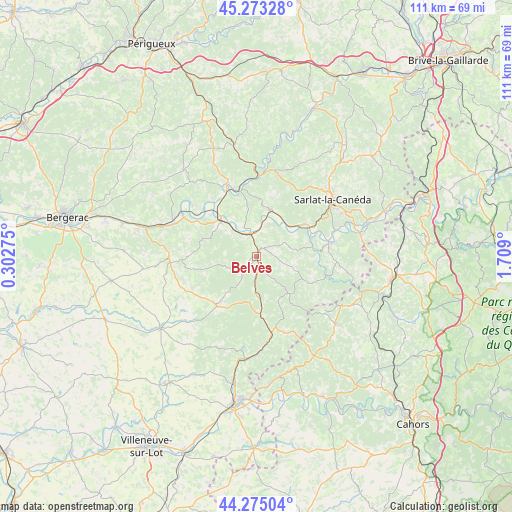
Belvès GPS coordinates[2]
44° 46' 34.752" North, 1° 0' 21.168" East
| Map corner | latitude | longitude |
|---|---|---|
| Upper-left | 45.27328°, | 0.30275° |
| Center: | 44.77632°, | 1.00588° |
| Lower-right: | 44.27504°, | 1.709° |
| Map W x H: | 111×111 km | = 69×69mi |
| max Lat: | 51.07786° ⇑81.6% North |
| Belvès: | 44.77632° |
| min Lat: | ⇓18.4% South 41.3874° |
| min Long | Belvès | max Long |
| -5.08615° | 1.00588° | 9.52242° |
| W 31.3%⇐ | ⇒68.7% E |
Elevation
Elevation of Belvès is 174 m = 571 ft, and this is 19.7 m = 65 ft below average elevation for this country.
| Max E: |
2333 m = 7654 ft | 39.1% |
| Avg. | 193.7 m = 635 ft | |
| Belvès | 174 m = 571 ft | |
Min E: |
-1 m = -3 ft | 60.9% |
See also: France elevation on elevation.city.
Geographical zone
Belvès is located in North temperate zone (between Tropic of Cancer and the Arctic Circle). Distance of this Northern Tropic circle is 2372.7 km =1474.3 mi to South.| Distance of | km | miles | from Belvès |
|---|---|---|---|
| North Pole | 5028.4 | 3124.5 | to North |
| Arctic Circle | 2422.5 | 1505.3 | to North |
| Tropic Cancer | 2372.7 | 1474.3 | to South |
| Equator | 4978.7 | 3093.6 | to South |


Nearby cities:
15 places around Belvès: (largest is in red/bold)
• Beynac-et-Cazenac
13 km =8.1 mi,  57°
57°
• Capdrot
12.4 km =7.7 mi,  211°
211°
• Coux-et-Bigaroque
6.9 km =4.3 mi,  337°
337°
• Cénac-et-Saint-Julien
16 km =9.9 mi,  80°
80°
• Daglan
15.2 km =9.4 mi,  104°
104°
• Domme
16.7 km =10.4 mi, 80°
• Le Bugue
17 km =10.6 mi, 338°
• Le Buisson-de-Cadouin
10.8 km =6.7 mi,  319°
319°
• Les Eyzies-de-Tayac-Sireuil
17.8 km =11.1 mi,  1°
1°
• Monpazier
13.7 km =8.5 mi,  219°
219°
• Saint-Cyprien
10.7 km =6.6 mi,  15°
15°
• Siorac-en-Périgord
5.3 km =3.3 mi, 343°
• Trémolat
17.6 km =10.9 mi,  308°
308°
• Villefranche-du-Périgord
17.4 km =10.8 mi,  160°
160°
• Vézac
14 km =8.7 mi, 62°
Sources, notices
• [Note1] Compared only with cities in France existing in our database
• [Src1] Map data: © OpenStreetMap contributors (CC-BY-SA)
• [Src2] Other city data from geonames.org with taken over terms of usage.
• [Src3] Geographical zone / Annual Mean Temperature by Robert A. Rohde @ Wikipedia
