Le Buisson-de-Cadouin geodata
Le Buisson-de-Cadouin (Nouvelle-Aquitaine) is a populated place; located in France in Europe/Paris (GMT+2) time zone. With population of 2,143 people, there are 4482 cities with bigger population in this country. Compared to other cities in France, 81% of cities are located further ↑North; 69.6% of cities are located further →East and 79.4% of cities have higher elevation than Le Buisson-de-Cadouin. Note1
Administrative division(s):
- Level 1: Nouvelle-Aquitaine
- Level 2: Dordogne
- Level 3: Arrondissement de Bergerac
- Level 4: Le Buisson-de-Cadouin
Current local time in Le Buisson-de-Cadouin:
02:02 PM, SaturdayDifference from your time zone: hours


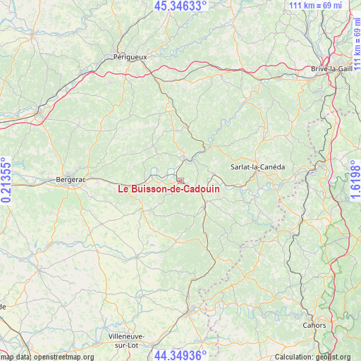
Le Buisson-de-Cadouin GPS coordinates[2]
44° 51' 0" North, 0° 55' 0.012" East
| Map corner | latitude | longitude |
|---|---|---|
| Upper-left | 45.34633°, | 0.21355° |
| Center: | 44.85°, | 0.91667° |
| Lower-right: | 44.34936°, | 1.6198° |
| Map W x H: | 110.9×110.9 km | = 68.9×68.9mi |
| max Lat: | 51.07786° ⇑81% North |
| Le Buisson-de-Cadouin: | 44.85° |
| min Lat: | ⇓19% South 41.3874° |
| min Long | Le Buisson-de-C | max Long |
| -5.08615° | 0.91667° | 9.52242° |
| W 30.4%⇐ | ⇒69.6% E |
Elevation
Elevation of Le Buisson-de-Cadouin is 56 m = 184 ft, and this is 137.7 m = 452 ft below average elevation for this country.
| Max E: |
2333 m = 7654 ft | 79.4% |
| Avg. | 193.7 m = 635 ft | |
| Le Buisson-de-Cadouin | 56 m = 184 ft | |
Min E: |
-1 m = -3 ft | 20.6% |
See also: France elevation on elevation.city.
Geographical zone
Le Buisson-de-Cadouin is located in North temperate zone (between Tropic of Cancer and the Arctic Circle). Distance of this Northern Tropic circle is 2380.9 km =1479.4 mi to South.| Distance of | km | miles | from Le Buisson-de-Cadouin |
|---|---|---|---|
| North Pole | 5020.2 | 3119.4 | to North |
| Arctic Circle | 2414.3 | 1500.2 | to North |
| Tropic Cancer | 2380.9 | 1479.4 | to South |
| Equator | 4986.9 | 3098.7 | to South |


Nearby cities:
15 places around Le Buisson-de-Cadouin: (largest is in red/bold)
• Beaumont-du-Périgord
14.9 km =9.3 mi,  231°
231°
• Belvès
10.8 km =6.7 mi,  139°
139°
• Beynac-et-Cazenac
17.9 km =11.1 mi,  93°
93°
• Capdrot
18.8 km =11.7 mi,  178°
178°
• Cendrieux
17.8 km =11.1 mi,  335°
335°
• Coux-et-Bigaroque
4.8 km =3 mi,  112°
112°
• Couze-et-Saint-Front
16.8 km =10.4 mi,  261°
261°
• Lalinde
14.7 km =9.1 mi, 264°
• Le Bugue
7.7 km =4.8 mi,  6°
6°
• Les Eyzies-de-Tayac-Sireuil
12.2 km =7.6 mi,  38°
38°
• Mauzac-et-Grand-Castang
10.7 km =6.6 mi,  280°
280°
• Saint-Cyprien
10.1 km =6.3 mi,  77°
77°
• Sainte-Alvère
13.6 km =8.5 mi,  324°
324°
• Siorac-en-Périgord
6.4 km =4 mi,  119°
119°
• Trémolat
7.3 km =4.5 mi,  292°
292°
Sources, notices
• [Note1] Compared only with cities in France existing in our database
• [Src1] Map data: © OpenStreetMap contributors (CC-BY-SA)
• [Src2] Other city data from geonames.org with taken over terms of usage.
• [Src3] Geographical zone / Annual Mean Temperature by Robert A. Rohde @ Wikipedia
