Beauvallon geodata
Beauvallon (Auvergne-Rhône-Alpes) is a populated place; located in France in Europe/Paris (GMT+2) time zone. With population of 1,818 people, there are 5221 cities with bigger population in this country. Compared to other cities in France, 80.8% of cities are located further ↑North; 76.6% of cities are located further ←West and 52.5% of cities have lower elevation than Beauvallon. Note1
Administrative division(s):
- Level 1: Auvergne-Rhône-Alpes
- Level 2: Département de la Drôme
- Level 3: Arrondissement de Valence
- Level 4: Beauvallon


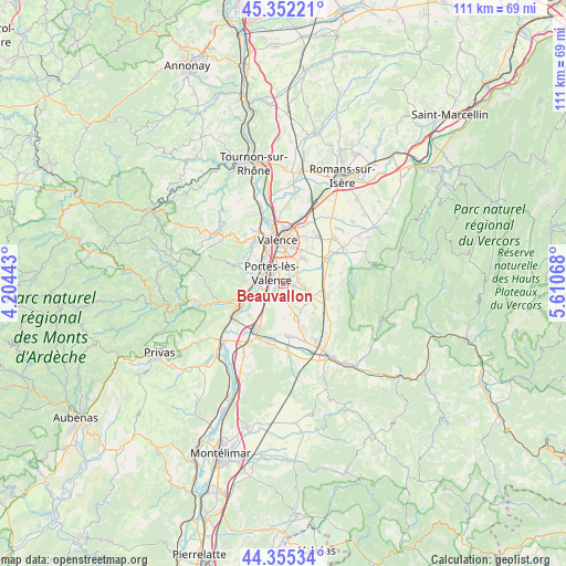
Beauvallon GPS coordinates[2]
44° 51' 21.348" North, 4° 54' 27.216" East
| Map corner | latitude | longitude |
|---|---|---|
| Upper-left | 45.35221°, | 4.20443° |
| Center: | 44.85593°, | 4.90756° |
| Lower-right: | 44.35534°, | 5.61068° |
| Map W x H: | 110.8×110.8 km | = 68.8×68.8mi |
| max Lat: | 51.07786° ⇑80.8% North |
| Beauvallon: | 44.85593° |
| min Lat: | ⇓19.2% South 41.3874° |
| min Long | Beauvallon | max Long |
| -5.08615° | 4.90756° | 9.52242° |
| W 76.6%⇐ | ⇒23.4% E |
Elevation
Elevation of Beauvallon is 141 m = 463 ft, and this is 52.7 m = 173 ft below average elevation for this country.
| Max E: |
2333 m = 7654 ft | 47.5% |
| Avg. | 193.7 m = 635 ft | |
| Beauvallon | 141 m = 463 ft | |
Min E: |
-1 m = -3 ft | 52.5% |
See also: France elevation on elevation.city.
Geographical zone
Beauvallon is located in North temperate zone (between Tropic of Cancer and the Arctic Circle). Distance of this Northern Tropic circle is 2381.6 km =1479.9 mi to South.| Distance of | km | miles | from Beauvallon |
|---|---|---|---|
| North Pole | 5019.6 | 3119 | to North |
| Arctic Circle | 2413.7 | 1499.8 | to North |
| Tropic Cancer | 2381.6 | 1479.9 | to South |
| Equator | 4987.5 | 3099.1 | to South |


Nearby cities:
15 places around Beauvallon: (largest is in red/bold)
• Beauchastel
8.9 km =5.5 mi,  247°
247°
• Beaumont-lès-Valence
2.9 km =1.8 mi,  76°
76°
• Charmes-sur-Rhône
5.8 km =3.6 mi,  278°
278°
• Guilherand-Granges
9 km =5.6 mi,  342°
342°
• Malissard
6.1 km =3.8 mi,  36°
36°
• Montmeyran
5.6 km =3.5 mi,  115°
115°
• Montoison
7.2 km =4.5 mi,  158°
158°
• Montéléger
2.3 km =1.4 mi,  98°
98°
• Portes-lès-Valence
3.4 km =2.1 mi,  310°
310°
• Saint-Georges-les-Bains
7.8 km =4.8 mi,  274°
274°
• Soyons
5.8 km =3.6 mi, 309°
• Toulaud
8.6 km =5.3 mi,  302°
302°
• Upie
8.1 km =5 mi,  137°
137°
• Valence
7.7 km =4.8 mi,  1°
1°
• Étoile-sur-Rhône
2.3 km =1.4 mi,  215°
215°
Sources, notices
• [Note1] Compared only with cities in France existing in our database
• [Src1] Map data: © OpenStreetMap contributors (CC-BY-SA)
• [Src2] Other city data from geonames.org with taken over terms of usage.
• [Src3] Geographical zone / Annual Mean Temperature by Robert A. Rohde @ Wikipedia
