Portes-lès-Valence geodata
Portes-lès-Valence (Auvergne-Rhône-Alpes) is a populated place; located in France in Europe/Paris (GMT+2) time zone. With population of 8,675 people, there are 1109 cities with bigger population in this country. Compared to other cities in France, 80.7% of cities are located further ↑North; 76.1% of cities are located further ←West and 53.8% of cities have higher elevation than Portes-lès-Valence. Note1
Administrative division(s):
- Level 1: Auvergne-Rhône-Alpes
- Level 2: Département de la Drôme
- Level 3: Arrondissement de Valence
- Level 4: Portes-lès-Valence


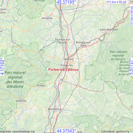
Portes-lès-Valence GPS coordinates[2]
44° 52' 33.06" North, 4° 52' 26.94" East
| Map corner | latitude | longitude |
|---|---|---|
| Upper-left | 45.37195°, | 4.17102° |
| Center: | 44.87585°, | 4.87415° |
| Lower-right: | 44.37543°, | 5.57727° |
| Map W x H: | 110.8×110.8 km | = 68.8×68.8mi |
| max Lat: | 51.07786° ⇑80.7% North |
| Portes-lès-Valence: | 44.87585° |
| min Lat: | ⇓19.3% South 41.3874° |
| min Long | Portes-lès-Val | max Long |
| -5.08615° | 4.87415° | 9.52242° |
| W 76.1%⇐ | ⇒23.9% E |
Elevation
Elevation of Portes-lès-Valence is 120 m = 394 ft, and this is 73.7 m = 242 ft below average elevation for this country.
| Max E: |
2333 m = 7654 ft | 53.8% |
| Avg. | 193.7 m = 635 ft | |
| Portes-lès-Valence | 120 m = 394 ft | |
Min E: |
-1 m = -3 ft | 46.2% |
See also: France elevation on elevation.city.
Geographical zone
Portes-lès-Valence is located in North temperate zone (between Tropic of Cancer and the Arctic Circle). Distance of this Northern Tropic circle is 2383.8 km =1481.2 mi to South.| Distance of | km | miles | from Portes-lès-Valence |
|---|---|---|---|
| North Pole | 5017.3 | 3117.6 | to North |
| Arctic Circle | 2411.4 | 1498.4 | to North |
| Tropic Cancer | 2383.8 | 1481.2 | to South |
| Equator | 4989.7 | 3100.5 | to South |


Nearby cities:
15 places around Portes-lès-Valence: (largest is in red/bold)
• Beauchastel
7.9 km =4.9 mi,  225°
225°
• Beaumont-lès-Valence
5.6 km =3.5 mi,  105°
105°
• Beauvallon
3.4 km =2.1 mi,  130°
130°
• Bourg-lès-Valence
8.1 km =5 mi,  11°
11°
• Charmes-sur-Rhône
3.3 km =2.1 mi,  246°
246°
• Guilherand-Granges
6.3 km =3.9 mi,  359°
359°
• Malissard
6.8 km =4.2 mi,  67°
67°
• Montmeyran
9 km =5.6 mi,  121°
121°
• Montéléger
5.5 km =3.4 mi, 117°
• Saint-Georges-les-Bains
5.4 km =3.4 mi, 252°
• Saint-Péray
8.4 km =5.2 mi,  344°
344°
• Soyons
2.4 km =1.5 mi,  308°
308°
• Toulaud
5.2 km =3.2 mi,  298°
298°
• Valence
6.2 km =3.9 mi,  26°
26°
• Étoile-sur-Rhône
4.3 km =2.7 mi,  162°
162°
Sources, notices
• [Note1] Compared only with cities in France existing in our database
• [Src1] Map data: © OpenStreetMap contributors (CC-BY-SA)
• [Src2] Other city data from geonames.org with taken over terms of usage.
• [Src3] Geographical zone / Annual Mean Temperature by Robert A. Rohde @ Wikipedia
