Beaumont-lès-Valence geodata
Beaumont-lès-Valence (Auvergne-Rhône-Alpes) is a populated place; located in France in Europe/Paris (GMT+2) time zone. With population of 3,982 people, there are 2469 cities with bigger population in this country. Compared to other cities in France, 80.8% of cities are located further ↑North; 77% of cities are located further ←West and 54.7% of cities have lower elevation than Beaumont-lès-Valence. Note1
Administrative division(s):
- Level 1: Auvergne-Rhône-Alpes
- Level 2: Département de la Drôme
- Level 3: Arrondissement de Valence
- Level 4: Beaumont-lès-Valence
Current local time in Beaumont-lès-Valence:
05:53 AM, WednesdayDifference from your time zone: hours


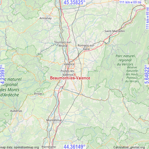
Beaumont-lès-Valence GPS coordinates[2]
44° 51' 43.308" North, 4° 56' 35.124" East
| Map corner | latitude | longitude |
|---|---|---|
| Upper-left | 45.35825°, | 4.23997° |
| Center: | 44.86203°, | 4.94309° |
| Lower-right: | 44.36149°, | 5.64622° |
| Map W x H: | 110.8×110.8 km | = 68.8×68.8mi |
| max Lat: | 51.07786° ⇑80.8% North |
| Beaumont-lès-Valence: | 44.86203° |
| min Lat: | ⇓19.2% South 41.3874° |
| min Long | Beaumont-lès-V | max Long |
| -5.08615° | 4.94309° | 9.52242° |
| W 77%⇐ | ⇒23% E |
Elevation
Elevation of Beaumont-lès-Valence is 149 m = 489 ft, and this is 44.7 m = 147 ft below average elevation for this country.
| Max E: |
2333 m = 7654 ft | 45.3% |
| Avg. | 193.7 m = 635 ft | |
| Beaumont-lès-Valence | 149 m = 489 ft | |
Min E: |
-1 m = -3 ft | 54.7% |
See also: France elevation on elevation.city.
Geographical zone
Beaumont-lès-Valence is located in North temperate zone (between Tropic of Cancer and the Arctic Circle). Distance of this Northern Tropic circle is 2382.3 km =1480.3 mi to South.| Distance of | km | miles | from Beaumont-lès-Valence |
|---|---|---|---|
| North Pole | 5018.9 | 3118.6 | to North |
| Arctic Circle | 2413 | 1499.4 | to North |
| Tropic Cancer | 2382.3 | 1480.3 | to South |
| Equator | 4988.2 | 3099.5 | to South |


Nearby cities:
15 places around Beaumont-lès-Valence: (largest is in red/bold)
• Beauvallon
2.9 km =1.8 mi,  256°
256°
• Bourg-lès-Valence
10.2 km =6.3 mi,  338°
338°
• Chabeuil
6.9 km =4.3 mi,  54°
54°
• Charmes-sur-Rhône
8.5 km =5.3 mi,  271°
271°
• Guilherand-Granges
9.6 km =6 mi,  325°
325°
• Malissard
4.3 km =2.7 mi,  11°
11°
• Montmeyran
3.9 km =2.4 mi,  144°
144°
• Montoison
7.3 km =4.5 mi,  181°
181°
• Montvendre
6.6 km =4.1 mi,  81°
81°
• Montéléger
1.2 km =0.7 mi,  209°
209°
• Portes-lès-Valence
5.6 km =3.5 mi,  285°
285°
• Soyons
7.9 km =4.9 mi, 292°
• Upie
7.1 km =4.4 mi,  158°
158°
• Valence
7.5 km =4.7 mi, 339°
• Étoile-sur-Rhône
4.9 km =3 mi,  238°
238°
Sources, notices
• [Note1] Compared only with cities in France existing in our database
• [Src1] Map data: © OpenStreetMap contributors (CC-BY-SA)
• [Src2] Other city data from geonames.org with taken over terms of usage.
• [Src3] Geographical zone / Annual Mean Temperature by Robert A. Rohde @ Wikipedia
