Bazet geodata
Bazet (Occitanie) is a populated place; located in France in Europe/Paris (GMT+2) time zone. With population of 1,331 people, there are 6889 cities with bigger population in this country. Compared to other cities in France, 95.9% of cities are located further ↑North; 77.5% of cities are located further →East and 77.9% of cities have lower elevation than Bazet. Note1
Administrative division(s):
- Level 1: Occitanie
- Level 2: Département des Hautes-Pyrénées
- Level 3: Arrondissement de Tarbes
- Level 4: Bazet


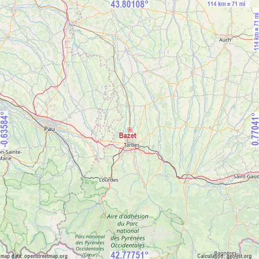
Bazet GPS coordinates[2]
43° 17' 29.22" North, 0° 4' 2.208" East
| Map corner | latitude | longitude |
|---|---|---|
| Upper-left | 43.80108°, | -0.63584° |
| Center: | 43.29145°, | 0.06728° |
| Lower-right: | 42.77751°, | 0.77041° |
| Map W x H: | 113.8×113.8 km | = 70.7×70.7mi |
| max Lat: | 51.07786° ⇑95.9% North |
| Bazet: | 43.29145° |
| min Lat: | ⇓4.1% South 41.3874° |
| min Long | Bazet | max Long |
| -5.08615° | 0.06728° | 9.52242° |
| W 22.5%⇐ | ⇒77.5% E |
Elevation
Elevation of Bazet is 271 m = 889 ft, and this is 77.3 m = 254 ft above average elevation for this country.
| Max E: |
2333 m = 7654 ft | 22.1% |
| Bazet | 271 m 889 ft | |
| Avg. | 193.7 m = 635 ft | |
Min E: |
-1 m = -3 ft | 77.9% |
See also: France elevation on elevation.city.
Geographical zone
Bazet is located in North temperate zone (between Tropic of Cancer and the Arctic Circle). Distance of this Northern Tropic circle is 2207.6 km =1371.7 mi to South.| Distance of | km | miles | from Bazet |
|---|---|---|---|
| North Pole | 5193.5 | 3227.1 | to North |
| Arctic Circle | 2587.6 | 1607.9 | to North |
| Tropic Cancer | 2207.6 | 1371.7 | to South |
| Equator | 4813.6 | 2991 | to South |


Nearby cities:
15 places around Bazet: (largest is in red/bold)
• Andrest
3.2 km =2 mi,  355°
355°
• Aureilhan
5.8 km =3.6 mi,  156°
156°
• Aurensan
2.2 km =1.4 mi,  44°
44°
• Bours
2.5 km =1.6 mi,  131°
131°
• Ibos
8.5 km =5.3 mi,  220°
220°
• Laloubère
9.7 km =6 mi,  177°
177°
• Montaner
8.6 km =5.3 mi,  312°
312°
• Orleix
4.5 km =2.8 mi,  107°
107°
• Oursbelille
2.7 km =1.7 mi,  254°
254°
• Pouyastruc
8.5 km =5.3 mi, 108°
• Pujo
6.2 km =3.9 mi,  0°
0°
• Sarrouilles
8.4 km =5.2 mi,  144°
144°
• Soues
9.7 km =6 mi, 164°
• Séméac
7.6 km =4.7 mi, 155°
• Tarbes
6.6 km =4.1 mi,  168°
168°
Sources, notices
• [Note1] Compared only with cities in France existing in our database
• [Src1] Map data: © OpenStreetMap contributors (CC-BY-SA)
• [Src2] Other city data from geonames.org with taken over terms of usage.
• [Src3] Geographical zone / Annual Mean Temperature by Robert A. Rohde @ Wikipedia
