La Bresse geodata
La Bresse (Grand Est) is a populated place; located in France in Europe/Paris (GMT+2) time zone. With population of 5,096 people, there are 1931 cities with bigger population in this country. Compared to other cities in France, 59.3% of cities are located further ↓South; 94% of cities are located further ←West and 95.6% of cities have lower elevation than La Bresse. Note1
Administrative division(s):
- Level 1: Grand Est
- Level 2: Vosges
- Level 3: Arrondissement d’Épinal
- Level 4: La Bresse


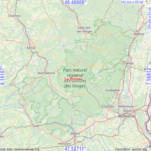
La Bresse GPS coordinates[2]
47° 59' 59.064" North, 6° 51' 53.964" East
| Map corner | latitude | longitude |
|---|---|---|
| Upper-left | 48.46808°, | 6.16187° |
| Center: | 47.99974°, | 6.86499° |
| Lower-right: | 47.52711°, | 7.56812° |
| Map W x H: | 104.6×104.6 km | = 65×65mi |
| max Lat: | 51.07786° ⇑40.7% North |
| La Bresse: | 47.99974° |
| min Lat: | ⇓59.3% South 41.3874° |
| min Long | La Bresse | max Long |
| -5.08615° | 6.86499° | 9.52242° |
| W 94%⇐ | ⇒6% E |
Elevation
Elevation of La Bresse is 617 m = 2024 ft, and this is 423.3 m = 1389 ft above average elevation for this country.
| Max E: |
2333 m = 7654 ft | 4.4% |
| La Bresse | 617 m 2024 ft | |
| Avg. | 193.7 m = 635 ft | |
Min E: |
-1 m = -3 ft | 95.6% |
See also: France elevation on elevation.city.
Geographical zone
La Bresse is located in North temperate zone (between Tropic of Cancer and the Arctic Circle). Distance of this North polar circle is 2064.1 km =1282.6 mi to North.| Distance of | km | miles | from La Bresse |
|---|---|---|---|
| North Pole | 4670 | 2901.8 | to North |
| Arctic Circle | 2064.1 | 1282.6 | to North |
| Tropic Cancer | 2731.2 | 1697.1 | to South |
| Equator | 5337.1 | 3316.3 | to South |


Nearby cities:
15 places around La Bresse: (largest is in red/bold)
• Basse-sur-le-Rupt
8.2 km =5.1 mi,  259°
259°
• Bussang
12.8 km =8 mi,  184°
184°
• Cornimont
5.1 km =3.2 mi,  210°
210°
• Gérardmer
8.3 km =5.2 mi,  6°
6°
• Kruth
10.7 km =6.6 mi,  135°
135°
• La Forge
12.8 km =8 mi,  304°
304°
• Le Ménil
12.2 km =7.6 mi, 210°
• Oderen
12.9 km =8 mi, 140°
• Rochesson
6.3 km =3.9 mi,  293°
293°
• Sapois
8.7 km =5.4 mi,  284°
284°
• Saulxures-sur-Moselotte
9 km =5.6 mi,  231°
231°
• Thiéfosse
10.5 km =6.5 mi,  251°
251°
• Vagney
11 km =6.8 mi,  273°
273°
• Ventron
6.7 km =4.2 mi, 176°
• Xonrupt-Longemer
10.3 km =6.4 mi,  27°
27°
Sources, notices
• [Note1] Compared only with cities in France existing in our database
• [Src1] Map data: © OpenStreetMap contributors (CC-BY-SA)
• [Src2] Other city data from geonames.org with taken over terms of usage.
• [Src3] Geographical zone / Annual Mean Temperature by Robert A. Rohde @ Wikipedia
