Chaource geodata
Chaource (Grand Est) is a populated place; located in France in Europe/Paris (GMT+2) time zone. With population of 1,109 people, there are 8069 cities with bigger population in this country. Compared to other cities in France, 60.4% of cities are located further ↓South; 69.2% of cities are located further ←West and 54.2% of cities have lower elevation than Chaource. Note1
Administrative division(s):
- Level 1: Grand Est
- Level 2: Département de l'Aube
- Level 3: Arrondissement de Troyes
- Level 4: Chaource


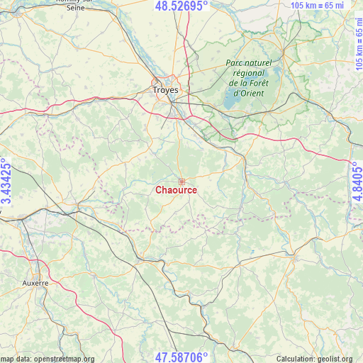
Chaource GPS coordinates[2]
48° 3' 32.94" North, 4° 8' 14.568" East
| Map corner | latitude | longitude |
|---|---|---|
| Upper-left | 48.52695°, | 3.43425° |
| Center: | 48.05915°, | 4.13738° |
| Lower-right: | 47.58706°, | 4.8405° |
| Map W x H: | 104.5×104.5 km | = 64.9×64.9mi |
| max Lat: | 51.07786° ⇑39.6% North |
| Chaource: | 48.05915° |
| min Lat: | ⇓60.4% South 41.3874° |
| min Long | Chaource | max Long |
| -5.08615° | 4.13738° | 9.52242° |
| W 69.2%⇐ | ⇒30.8% E |
Elevation
Elevation of Chaource is 147 m = 482 ft, and this is 46.7 m = 153 ft below average elevation for this country.
| Max E: |
2333 m = 7654 ft | 45.8% |
| Avg. | 193.7 m = 635 ft | |
| Chaource | 147 m = 482 ft | |
Min E: |
-1 m = -3 ft | 54.2% |
See also: France elevation on elevation.city.
Geographical zone
Chaource is located in North temperate zone (between Tropic of Cancer and the Arctic Circle). Distance of this North polar circle is 2057.5 km =1278.5 mi to North.| Distance of | km | miles | from Chaource |
|---|---|---|---|
| North Pole | 4663.4 | 2897.7 | to North |
| Arctic Circle | 2057.5 | 1278.5 | to North |
| Tropic Cancer | 2737.8 | 1701.2 | to South |
| Equator | 5343.7 | 3320.4 | to South |


Nearby cities:
15 places around Chaource: (largest is in red/bold)
• Auxon
17.1 km =10.6 mi,  287°
287°
• Bar-sur-Seine
18.7 km =11.6 mi,  71°
71°
• Bouilly
18.4 km =11.4 mi,  326°
326°
• Buchères
19.6 km =12.2 mi,  354°
354°
• Chessy-les-Prés
17 km =10.6 mi,  256°
256°
• Clérey
17.2 km =10.7 mi,  13°
13°
• Ervy-le-Châtel
17 km =10.6 mi, 263°
• Isle-Aumont
17.1 km =10.6 mi,  357°
357°
• Les Riceys
18.7 km =11.6 mi,  112°
112°
• Saint-Parres-lès-Vaudes
13.7 km =8.5 mi,  25°
25°
• Saint-Pouange
20 km =12.4 mi,  338°
338°
• Vaudes
13.8 km =8.6 mi,  16°
16°
• Verrières
19.4 km =12.1 mi,  2°
2°
• Villemoyenne
14.9 km =9.3 mi, 26°
• Virey-sous-Bar
15.7 km =9.8 mi,  55°
55°
Sources, notices
• [Note1] Compared only with cities in France existing in our database
• [Src1] Map data: © OpenStreetMap contributors (CC-BY-SA)
• [Src2] Other city data from geonames.org with taken over terms of usage.
• [Src3] Geographical zone / Annual Mean Temperature by Robert A. Rohde @ Wikipedia
