Bailly-Carrois geodata
Bailly-Carrois (Île-de-France) is a populated place; located in France in Europe/Paris (GMT+2) time zone. With population of 1,044 people, there are 8506 cities with bigger population in this country. Compared to other cities in France, 70.3% of cities are located further ↓South; 57.7% of cities are located further ←West and 53.8% of cities have higher elevation than Bailly-Carrois. Note1
Administrative division(s):
- Level 1: Île-de-France
- Level 2: Seine-et-Marne
- Level 3: Arrondissement de Provins
- Level 4: Grandpuits-Bailly-Carrois


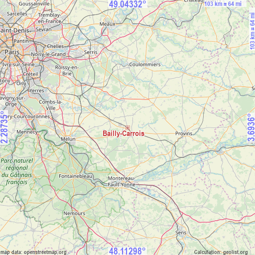
Bailly-Carrois GPS coordinates[2]
48° 34' 49.044" North, 2° 59' 25.692" East
| Map corner | latitude | longitude |
|---|---|---|
| Upper-left | 49.04332°, | 2.28735° |
| Center: | 48.58029°, | 2.99047° |
| Lower-right: | 48.11298°, | 3.6936° |
| Map W x H: | 103.4×103.4 km | = 64.2×64.2mi |
| max Lat: | 51.07786° ⇑29.7% North |
| Bailly-Carrois: | 48.58029° |
| min Lat: | ⇓70.3% South 41.3874° |
| min Long | Bailly-Carrois | max Long |
| -5.08615° | 2.99047° | 9.52242° |
| W 57.7%⇐ | ⇒42.3% E |
Elevation
Elevation of Bailly-Carrois is 120 m = 394 ft, and this is 73.7 m = 242 ft below average elevation for this country.
| Max E: |
2333 m = 7654 ft | 53.8% |
| Avg. | 193.7 m = 635 ft | |
| Bailly-Carrois | 120 m = 394 ft | |
Min E: |
-1 m = -3 ft | 46.2% |
See also: France elevation on elevation.city.
Geographical zone
Bailly-Carrois is located in North temperate zone (between Tropic of Cancer and the Arctic Circle). Distance of this North polar circle is 1999.6 km =1242.5 mi to North.| Distance of | km | miles | from Bailly-Carrois |
|---|---|---|---|
| North Pole | 4605.4 | 2861.7 | to North |
| Arctic Circle | 1999.6 | 1242.5 | to North |
| Tropic Cancer | 2795.7 | 1737.2 | to South |
| Equator | 5401.6 | 3356.4 | to South |


Nearby cities:
15 places around Bailly-Carrois: (largest is in red/bold)
• Aubepierre-Ozouer-le-Repos
9.8 km =6.1 mi,  306°
306°
• Bombon
9.6 km =6 mi,  264°
264°
• Courpalay
8 km =5 mi,  344°
344°
• Courtomer
10.3 km =6.4 mi,  321°
321°
• Fontenailles
4.2 km =2.6 mi,  221°
221°
• Gastins
5.9 km =3.7 mi,  21°
21°
• La Chapelle-Gauthier
7.6 km =4.7 mi,  243°
243°
• La Chapelle-Rablais
7.8 km =4.8 mi,  190°
190°
• La Croix-en-Brie
6.5 km =4 mi,  76°
76°
• Mormant
8 km =5 mi,  293°
293°
• Nangis
3.2 km =2 mi,  149°
149°
• Pécy
10.7 km =6.6 mi,  38°
38°
• Quiers
3.3 km =2.1 mi,  332°
332°
• Rampillon
6.5 km =4 mi,  120°
120°
• Saint-Ouen-en-Brie
5.8 km =3.6 mi, 244°
Sources, notices
• [Note1] Compared only with cities in France existing in our database
• [Src1] Map data: © OpenStreetMap contributors (CC-BY-SA)
• [Src2] Other city data from geonames.org with taken over terms of usage.
• [Src3] Geographical zone / Annual Mean Temperature by Robert A. Rohde @ Wikipedia
