Auxy geodata
Auxy (Centre) is a populated place; located in France in Europe/Paris (GMT+2) time zone. With population of 901 people, there are 9647 cities with bigger population in this country. Compared to other cities in France, 61.5% of cities are located further ↓South; 50.2% of cities are located further ←West and 55.9% of cities have higher elevation than Auxy. Note1
Administrative division(s):
- Level 1: Centre
- Level 2: Loiret
- Level 3: Arrondissement de Pithiviers
- Level 4: Auxy


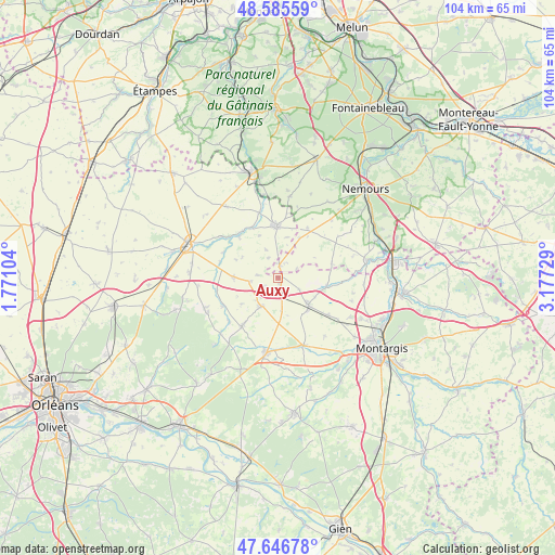
Auxy GPS coordinates[2]
48° 7' 5.988" North, 2° 28' 27.012" East
| Map corner | latitude | longitude |
|---|---|---|
| Upper-left | 48.58559°, | 1.77104° |
| Center: | 48.11833°, | 2.47417° |
| Lower-right: | 47.64678°, | 3.17729° |
| Map W x H: | 104.4×104.4 km | = 64.9×64.9mi |
| max Lat: | 51.07786° ⇑38.5% North |
| Auxy: | 48.11833° |
| min Lat: | ⇓61.5% South 41.3874° |
| min Long | Auxy | max Long |
| -5.08615° | 2.47417° | 9.52242° |
| W 50.2%⇐ | ⇒49.8% E |
Elevation
Elevation of Auxy is 114 m = 374 ft, and this is 79.7 m = 261 ft below average elevation for this country.
| Max E: |
2333 m = 7654 ft | 55.9% |
| Avg. | 193.7 m = 635 ft | |
| Auxy | 114 m = 374 ft | |
Min E: |
-1 m = -3 ft | 44.1% |
See also: France elevation on elevation.city.
Geographical zone
Auxy is located in North temperate zone (between Tropic of Cancer and the Arctic Circle). Distance of this North polar circle is 2050.9 km =1274.4 mi to North.| Distance of | km | miles | from Auxy |
|---|---|---|---|
| North Pole | 4656.8 | 2893.6 | to North |
| Arctic Circle | 2050.9 | 1274.4 | to North |
| Tropic Cancer | 2744.3 | 1705.2 | to South |
| Equator | 5350.3 | 3324.5 | to South |


Nearby cities:
15 places around Auxy: (largest is in red/bold)
• Aulnay-la-Rivière
11.3 km =7 mi,  315°
315°
• Beaumont-du-Gâtinais
2.3 km =1.4 mi,  9°
9°
• Beaune-la-Rolande
6.1 km =3.8 mi,  211°
211°
• Boiscommun
11.4 km =7.1 mi,  216°
216°
• Boynes
8.5 km =5.3 mi,  269°
269°
• Briarres-sur-Essonne
13.5 km =8.4 mi,  341°
341°
• Chambon-la-Forêt
15 km =9.3 mi,  242°
242°
• Corbeilles
7.6 km =4.7 mi,  132°
132°
• Estouy
13.2 km =8.2 mi,  305°
305°
• Ladon
13.7 km =8.5 mi,  159°
159°
• Lorcy
8.3 km =5.2 mi,  149°
149°
• Quiers-sur-Bézonde
13.8 km =8.6 mi,  190°
190°
• Sceaux-du-Gâtinais
9.1 km =5.7 mi,  98°
98°
• Villemoutiers
15.1 km =9.4 mi, 155°
• Yèvre-la-Ville
11.4 km =7.1 mi,  285°
285°
Sources, notices
• [Note1] Compared only with cities in France existing in our database
• [Src1] Map data: © OpenStreetMap contributors (CC-BY-SA)
• [Src2] Other city data from geonames.org with taken over terms of usage.
• [Src3] Geographical zone / Annual Mean Temperature by Robert A. Rohde @ Wikipedia
