Aulnay-la-Rivière geodata
Aulnay-la-Rivière (Centre) is a populated place; located in France in Europe/Paris (GMT+2) time zone. With population of 529 people, there are 14624 cities with bigger population in this country. Compared to other cities in France, 62.7% of cities are located further ↓South; 51.5% of cities are located further →East and 63.6% of cities have higher elevation than Aulnay-la-Rivière. Note1
Administrative division(s):
- Level 1: Centre
- Level 2: Loiret
- Level 3: Arrondissement de Pithiviers
- Level 4: Aulnay-la-Rivière


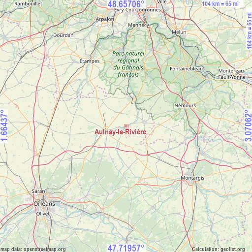
Aulnay-la-Rivière GPS coordinates[2]
48° 11' 25.656" North, 2° 22' 2.964" East
| Map corner | latitude | longitude |
|---|---|---|
| Upper-left | 48.65706°, | 1.66437° |
| Center: | 48.19046°, | 2.36749° |
| Lower-right: | 47.71957°, | 3.07062° |
| Map W x H: | 104.2×104.2 km | = 64.7×64.7mi |
| max Lat: | 51.07786° ⇑37.3% North |
| Aulnay-la-Rivière: | 48.19046° |
| min Lat: | ⇓62.7% South 41.3874° |
| min Long | Aulnay-la-Rivi� | max Long |
| -5.08615° | 2.36749° | 9.52242° |
| W 48.5%⇐ | ⇒51.5% E |
Elevation
Elevation of Aulnay-la-Rivière is 93 m = 305 ft, and this is 100.7 m = 330 ft below average elevation for this country.
| Max E: |
2333 m = 7654 ft | 63.6% |
| Avg. | 193.7 m = 635 ft | |
| Aulnay-la-Rivière | 93 m = 305 ft | |
Min E: |
-1 m = -3 ft | 36.4% |
See also: France elevation on elevation.city.
Geographical zone
Aulnay-la-Rivière is located in North temperate zone (between Tropic of Cancer and the Arctic Circle). Distance of this North polar circle is 2042.9 km =1269.4 mi to North.| Distance of | km | miles | from Aulnay-la-Rivière |
|---|---|---|---|
| North Pole | 4648.8 | 2888.6 | to North |
| Arctic Circle | 2042.9 | 1269.4 | to North |
| Tropic Cancer | 2752.4 | 1710.3 | to South |
| Equator | 5358.3 | 3329.5 | to South |


Nearby cities:
15 places around Aulnay-la-Rivière: (largest is in red/bold)
• Ascoux
10.9 km =6.8 mi,  230°
230°
• Auxy
11.3 km =7 mi,  135°
135°
• Beaumont-du-Gâtinais
10.1 km =6.3 mi,  124°
124°
• Beaune-la-Rolande
14.1 km =8.8 mi,  160°
160°
• Boynes
8.1 km =5 mi,  183°
183°
• Briarres-sur-Essonne
6 km =3.7 mi,  37°
37°
• Buthiers
11.8 km =7.3 mi,  23°
23°
• Dadonville
8 km =5 mi,  242°
242°
• Escrennes
14.8 km =9.2 mi, 244°
• Estouy
2.8 km =1.7 mi,  262°
262°
• Malesherbes
12.1 km =7.5 mi,  14°
14°
• Manchecourt
5.6 km =3.5 mi,  341°
341°
• Pithiviers
8.8 km =5.5 mi, 256°
• Pithiviers-le-Vieil
12.1 km =7.5 mi, 255°
• Yèvre-la-Ville
5.9 km =3.7 mi,  211°
211°
Sources, notices
• [Note1] Compared only with cities in France existing in our database
• [Src1] Map data: © OpenStreetMap contributors (CC-BY-SA)
• [Src2] Other city data from geonames.org with taken over terms of usage.
• [Src3] Geographical zone / Annual Mean Temperature by Robert A. Rohde @ Wikipedia
