Estouy geodata
Estouy (Centre) is a populated place; located in France in Europe/Paris (GMT+2) time zone. With population of 508 people, there are 15076 cities with bigger population in this country. Compared to other cities in France, 62.6% of cities are located further ↓South; 52.2% of cities are located further →East and 60.8% of cities have higher elevation than Estouy. Note1
Administrative division(s):
- Level 1: Centre
- Level 2: Loiret
- Level 3: Arrondissement de Pithiviers
- Level 4: Estouy


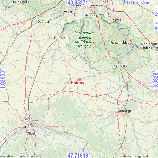
Estouy GPS coordinates[2]
48° 11' 13.488" North, 2° 19' 46.848" East
| Map corner | latitude | longitude |
|---|---|---|
| Upper-left | 48.65371°, | 1.62655° |
| Center: | 48.18708°, | 2.32968° |
| Lower-right: | 47.71616°, | 3.0328° |
| Map W x H: | 104.2×104.2 km | = 64.7×64.7mi |
| max Lat: | 51.07786° ⇑37.4% North |
| Estouy: | 48.18708° |
| min Lat: | ⇓62.6% South 41.3874° |
| min Long | Estouy | max Long |
| -5.08615° | 2.32968° | 9.52242° |
| W 47.8%⇐ | ⇒52.2% E |
Elevation
Elevation of Estouy is 100 m = 328 ft, and this is 93.7 m = 307 ft below average elevation for this country.
| Max E: |
2333 m = 7654 ft | 60.8% |
| Avg. | 193.7 m = 635 ft | |
| Estouy | 100 m = 328 ft | |
Min E: |
-1 m = -3 ft | 39.2% |
See also: France elevation on elevation.city.
Geographical zone
Estouy is located in North temperate zone (between Tropic of Cancer and the Arctic Circle). Distance of this North polar circle is 2043.3 km =1269.6 mi to North.| Distance of | km | miles | from Estouy |
|---|---|---|---|
| North Pole | 4649.2 | 2888.9 | to North |
| Arctic Circle | 2043.3 | 1269.6 | to North |
| Tropic Cancer | 2752 | 1710 | to South |
| Equator | 5357.9 | 3329.2 | to South |


Nearby cities:
15 places around Estouy: (largest is in red/bold)
• Ascoux
8.6 km =5.3 mi,  220°
220°
• Aulnay-la-Rivière
2.8 km =1.7 mi,  82°
82°
• Auxy
13.2 km =8.2 mi,  125°
125°
• Beaumont-du-Gâtinais
12.3 km =7.6 mi,  115°
115°
• Boynes
8 km =5 mi,  163°
163°
• Briarres-sur-Essonne
8.2 km =5.1 mi,  51°
51°
• Buthiers
13.4 km =8.3 mi,  34°
34°
• Dadonville
5.4 km =3.4 mi,  232°
232°
• Escrennes
12.1 km =7.5 mi,  240°
240°
• Malesherbes
13.4 km =8.3 mi, 26°
• Manchecourt
5.8 km =3.6 mi,  9°
9°
• Pithiviers
6 km =3.7 mi,  253°
253°
• Pithiviers-le-Vieil
9.3 km =5.8 mi, 253°
• Vrigny
13.3 km =8.3 mi,  206°
206°
• Yèvre-la-Ville
4.7 km =2.9 mi,  183°
183°
Sources, notices
• [Note1] Compared only with cities in France existing in our database
• [Src1] Map data: © OpenStreetMap contributors (CC-BY-SA)
• [Src2] Other city data from geonames.org with taken over terms of usage.
• [Src3] Geographical zone / Annual Mean Temperature by Robert A. Rohde @ Wikipedia
