Aunay-sous-Auneau geodata
Aunay-sous-Auneau (Centre) is a populated place; located in France in Europe/Paris (GMT+2) time zone. With population of 1,378 people, there are 6687 cities with bigger population in this country. Compared to other cities in France, 67.1% of cities are located further ↓South; 59.3% of cities are located further →East and 50.8% of cities have lower elevation than Aunay-sous-Auneau. Note1
Administrative division(s):
- Level 1: Centre
- Level 2: Département d'Eure-et-Loir
- Level 3: Arrondissement de Chartres
- Level 4: Aunay-sous-Auneau


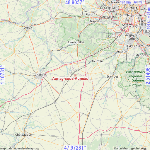
Aunay-sous-Auneau GPS coordinates[2]
48° 26' 29.04" North, 1° 48' 39.384" East
| Map corner | latitude | longitude |
|---|---|---|
| Upper-left | 48.9057°, | 1.10781° |
| Center: | 48.4414°, | 1.81094° |
| Lower-right: | 47.97281°, | 2.51406° |
| Map W x H: | 103.7×103.7 km | = 64.4×64.4mi |
| max Lat: | 51.07786° ⇑32.9% North |
| Aunay-sous-Auneau: | 48.4414° |
| min Lat: | ⇓67.1% South 41.3874° |
| min Long | Aunay-sous-Aune | max Long |
| -5.08615° | 1.81094° | 9.52242° |
| W 40.7%⇐ | ⇒59.3% E |
Elevation
Elevation of Aunay-sous-Auneau is 135 m = 443 ft, and this is 58.7 m = 193 ft below average elevation for this country.
| Max E: |
2333 m = 7654 ft | 49.2% |
| Avg. | 193.7 m = 635 ft | |
| Aunay-sous-Auneau | 135 m = 443 ft | |
Min E: |
-1 m = -3 ft | 50.8% |
See also: France elevation on elevation.city.
Geographical zone
Aunay-sous-Auneau is located in North temperate zone (between Tropic of Cancer and the Arctic Circle). Distance of this North polar circle is 2015 km =1252.1 mi to North.| Distance of | km | miles | from Aunay-sous-Auneau |
|---|---|---|---|
| North Pole | 4620.9 | 2871.3 | to North |
| Arctic Circle | 2015 | 1252.1 | to North |
| Tropic Cancer | 2780.3 | 1727.6 | to South |
| Equator | 5386.2 | 3346.8 | to South |


Nearby cities:
15 places around Aunay-sous-Auneau: (largest is in red/bold)
• Ablis
8.6 km =5.3 mi,  12°
12°
• Auneau
3.8 km =2.4 mi,  311°
311°
• Béville-le-Comte
7.2 km =4.5 mi,  264°
264°
• Corbreuse
12.8 km =8 mi,  58°
58°
• Denonville
5.6 km =3.5 mi,  179°
179°
• Francourville
11.8 km =7.3 mi,  250°
250°
• Gallardon
12.8 km =8 mi,  317°
317°
• Le Gué-de-Longroi
9.4 km =5.8 mi, 314°
• Ouarville
10 km =6.2 mi,  195°
195°
• Ponthévrard
14.3 km =8.9 mi,  30°
30°
• Saint-Escobille
11.5 km =7.1 mi,  94°
94°
• Saint-Symphorien-le-Château
9.2 km =5.7 mi,  336°
336°
• Sainville
5.9 km =3.7 mi,  120°
120°
• Ymeray
11.2 km =7 mi, 313°
• Écrosnes
13.1 km =8.1 mi,  332°
332°
Sources, notices
• [Note1] Compared only with cities in France existing in our database
• [Src1] Map data: © OpenStreetMap contributors (CC-BY-SA)
• [Src2] Other city data from geonames.org with taken over terms of usage.
• [Src3] Geographical zone / Annual Mean Temperature by Robert A. Rohde @ Wikipedia
