Francourville geodata
Francourville (Centre) is a populated place; located in France in Europe/Paris (GMT+2) time zone. With population of 802 people, there are 10583 cities with bigger population in this country. Compared to other cities in France, 66.5% of cities are located further ↓South; 60.9% of cities are located further →East and 55.3% of cities have lower elevation than Francourville. Note1
Administrative division(s):
- Level 1: Centre
- Level 2: Département d'Eure-et-Loir
- Level 3: Arrondissement de Chartres
- Level 4: Francourville


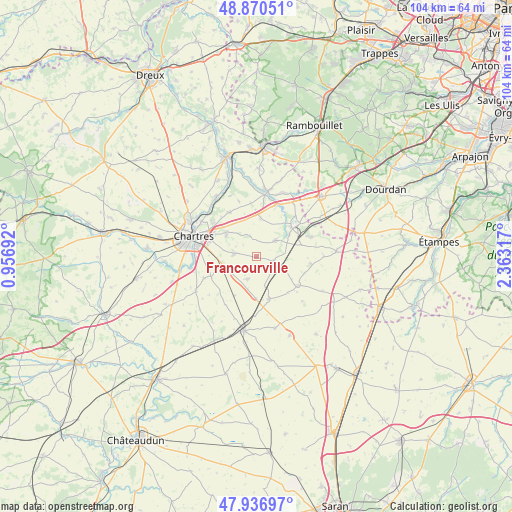
Francourville GPS coordinates[2]
48° 24' 21.168" North, 1° 39' 36.144" East
| Map corner | latitude | longitude |
|---|---|---|
| Upper-left | 48.87051°, | 0.95692° |
| Center: | 48.40588°, | 1.66004° |
| Lower-right: | 47.93697°, | 2.36317° |
| Map W x H: | 103.8×103.8 km | = 64.5×64.5mi |
| max Lat: | 51.07786° ⇑33.5% North |
| Francourville: | 48.40588° |
| min Lat: | ⇓66.5% South 41.3874° |
| min Long | Francourville | max Long |
| -5.08615° | 1.66004° | 9.52242° |
| W 39.1%⇐ | ⇒60.9% E |
Elevation
Elevation of Francourville is 151 m = 495 ft, and this is 42.7 m = 140 ft below average elevation for this country.
| Max E: |
2333 m = 7654 ft | 44.7% |
| Avg. | 193.7 m = 635 ft | |
| Francourville | 151 m = 495 ft | |
Min E: |
-1 m = -3 ft | 55.3% |
See also: France elevation on elevation.city.
Geographical zone
Francourville is located in North temperate zone (between Tropic of Cancer and the Arctic Circle). Distance of this North polar circle is 2018.9 km =1254.5 mi to North.| Distance of | km | miles | from Francourville |
|---|---|---|---|
| North Pole | 4624.8 | 2873.7 | to North |
| Arctic Circle | 2018.9 | 1254.5 | to North |
| Tropic Cancer | 2776.3 | 1725.1 | to South |
| Equator | 5382.2 | 3344.3 | to South |


Nearby cities:
15 places around Francourville: (largest is in red/bold)
• Aunay-sous-Auneau
11.8 km =7.3 mi,  70°
70°
• Auneau
10.5 km =6.5 mi,  52°
52°
• Berchères-les-Pierres
8.1 km =5 mi,  253°
253°
• Boisville-la-Saint-Père
8.9 km =5.5 mi,  164°
164°
• Béville-le-Comte
5.1 km =3.2 mi, 49°
• Coltainville
10.5 km =6.5 mi,  329°
329°
• Denonville
11.4 km =7.1 mi,  98°
98°
• Gasville-Oisème
11.4 km =7.1 mi,  308°
308°
• Le Coudray
11.9 km =7.4 mi,  278°
278°
• Le Gué-de-Longroi
11.5 km =7.1 mi,  22°
22°
• Nogent-le-Phaye
7.5 km =4.7 mi, 305°
• Ouarville
10.2 km =6.3 mi,  124°
124°
• Prunay-le-Gillon
5 km =3.1 mi,  201°
201°
• Sours
4.5 km =2.8 mi, 276°
• Ymeray
12 km =7.5 mi,  14°
14°
Sources, notices
• [Note1] Compared only with cities in France existing in our database
• [Src1] Map data: © OpenStreetMap contributors (CC-BY-SA)
• [Src2] Other city data from geonames.org with taken over terms of usage.
• [Src3] Geographical zone / Annual Mean Temperature by Robert A. Rohde @ Wikipedia
