Aubers geodata
Aubers (Hauts-de-France) is a populated place; located in France in Europe/Paris (GMT+2) time zone. With population of 1,634 people, there are 5717 cities with bigger population in this country. Compared to other cities in France, 98.1% of cities are located further ↓South; 55.3% of cities are located further ←West and 90.3% of cities have higher elevation than Aubers. Note1
Administrative division(s):
- Level 1: Hauts-de-France
- Level 2: Nord
- Level 3: Arrondissement de Lille
- Level 4: Aubers


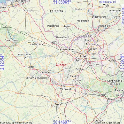
Aubers GPS coordinates[2]
50° 35' 43.548" North, 2° 49' 35.976" East
| Map corner | latitude | longitude |
|---|---|---|
| Upper-left | 51.03965°, | 2.12354° |
| Center: | 50.59543°, | 2.82666° |
| Lower-right: | 50.14697°, | 3.52979° |
| Map W x H: | 99.3×99.3 km | = 61.7×61.7mi |
| max Lat: | 51.07786° ⇑1.9% North |
| Aubers: | 50.59543° |
| min Lat: | ⇓98.1% South 41.3874° |
| min Long | Aubers | max Long |
| -5.08615° | 2.82666° | 9.52242° |
| W 55.3%⇐ | ⇒44.7% E |
Elevation
Elevation of Aubers is 29 m = 95 ft, and this is 164.7 m = 540 ft below average elevation for this country.
| Max E: |
2333 m = 7654 ft | 90.3% |
| Avg. | 193.7 m = 635 ft | |
| Aubers | 29 m = 95 ft | |
Min E: |
-1 m = -3 ft | 9.7% |
See also: France elevation on elevation.city.
Geographical zone
Aubers is located in North temperate zone (between Tropic of Cancer and the Arctic Circle). Distance of this North polar circle is 1775.5 km =1103.2 mi to North.| Distance of | km | miles | from Aubers |
|---|---|---|---|
| North Pole | 4381.4 | 2722.5 | to North |
| Arctic Circle | 1775.5 | 1103.2 | to North |
| Tropic Cancer | 3019.8 | 1876.4 | to South |
| Equator | 5625.7 | 3495.6 | to South |


Nearby cities:
15 places around Aubers: (largest is in red/bold)
• Beaucamps-Ligny
6.4 km =4 mi,  79°
79°
• Fleurbaix
6.2 km =3.9 mi,  4°
4°
• Fournes-en-Weppes
4.5 km =2.8 mi,  105°
105°
• Fromelles
2.3 km =1.4 mi,  55°
55°
• Herlies
2.7 km =1.7 mi,  137°
137°
• Illies
3.8 km =2.4 mi,  176°
176°
• Laventie
5.4 km =3.4 mi,  312°
312°
• Le Maisnil
4.7 km =2.9 mi, 62°
• Lorgies
3.9 km =2.4 mi,  220°
220°
• Marquillies
5.4 km =3.4 mi, 144°
• Neuve-Chapelle
3.3 km =2.1 mi,  251°
251°
• Radinghem-en-Weppes
6.4 km =4 mi,  65°
65°
• Richebourg-l'Avoué
6.2 km =3.9 mi,  242°
242°
• Sainghin-en-Weppes
6.1 km =3.8 mi,  124°
124°
• Violaines
6.6 km =4.1 mi,  204°
204°
Sources, notices
• [Note1] Compared only with cities in France existing in our database
• [Src1] Map data: © OpenStreetMap contributors (CC-BY-SA)
• [Src2] Other city data from geonames.org with taken over terms of usage.
• [Src3] Geographical zone / Annual Mean Temperature by Robert A. Rohde @ Wikipedia
