Artonne geodata
Artonne (Auvergne-Rhône-Alpes) is a populated place; located in France in Europe/Paris (GMT+2) time zone. With population of 807 people, there are 10522 cities with bigger population in this country. Compared to other cities in France, 66.2% of cities are located further ↑North; 59.8% of cities are located further ←West and 88.5% of cities have lower elevation than Artonne. Note1
Administrative division(s):
- Level 1: Auvergne-Rhône-Alpes
- Level 2: Département du Puy-de-Dôme
- Level 3: Arrondissement de Riom
- Level 4: Artonne


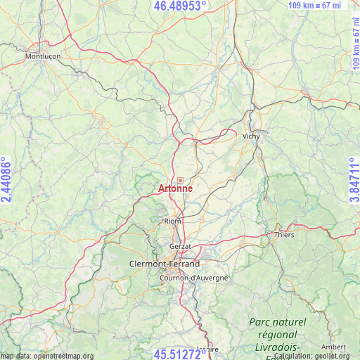
Artonne GPS coordinates[2]
46° 0' 11.808" North, 3° 8' 38.364" East
| Map corner | latitude | longitude |
|---|---|---|
| Upper-left | 46.48953°, | 2.44086° |
| Center: | 46.00328°, | 3.14399° |
| Lower-right: | 45.51272°, | 3.84711° |
| Map W x H: | 108.6×108.6 km | = 67.5×67.5mi |
| max Lat: | 51.07786° ⇑66.2% North |
| Artonne: | 46.00328° |
| min Lat: | ⇓33.8% South 41.3874° |
| min Long | Artonne | max Long |
| -5.08615° | 3.14399° | 9.52242° |
| W 59.8%⇐ | ⇒40.2% E |
Elevation
Elevation of Artonne is 397 m = 1302 ft, and this is 203.3 m = 667 ft above average elevation for this country.
| Max E: |
2333 m = 7654 ft | 11.5% |
| Artonne | 397 m 1302 ft | |
| Avg. | 193.7 m = 635 ft | |
Min E: |
-1 m = -3 ft | 88.5% |
See also: France elevation on elevation.city.
Geographical zone
Artonne is located in North temperate zone (between Tropic of Cancer and the Arctic Circle). Distance of this North polar circle is 2286.1 km =1420.5 mi to North.| Distance of | km | miles | from Artonne |
|---|---|---|---|
| North Pole | 4892 | 3039.7 | to North |
| Arctic Circle | 2286.1 | 1420.5 | to North |
| Tropic Cancer | 2509.2 | 1559.1 | to South |
| Equator | 5115.1 | 3178.4 | to South |


Nearby cities:
15 places around Artonne: (largest is in red/bold)
• Aigueperse
5 km =3.1 mi,  64°
64°
• Beauregard-Vendon
5.5 km =3.4 mi,  208°
208°
• Cellule
6.2 km =3.9 mi,  182°
182°
• Charbonnières-les-Vieilles
11.3 km =7 mi,  265°
265°
• Châtel-Guyon
10.9 km =6.8 mi, 214°
• Combronde
5 km =3.1 mi,  240°
240°
• Davayat
6.8 km =4.2 mi,  203°
203°
• Effiat
9.5 km =5.9 mi, 64°
• Gannat
11.5 km =7.1 mi,  21°
21°
• Loubeyrat
12.8 km =8 mi,  234°
234°
• Martres-sur-Morge
9.4 km =5.8 mi,  141°
141°
• Mozac
12.7 km =7.9 mi, 197°
• Riom
12.4 km =7.7 mi,  191°
191°
• Saint-Bonnet-près-Riom
8.5 km =5.3 mi, 196°
• Thuret
9.7 km =6 mi,  113°
113°
Sources, notices
• [Note1] Compared only with cities in France existing in our database
• [Src1] Map data: © OpenStreetMap contributors (CC-BY-SA)
• [Src2] Other city data from geonames.org with taken over terms of usage.
• [Src3] Geographical zone / Annual Mean Temperature by Robert A. Rohde @ Wikipedia
