Argancy geodata
Argancy (Grand Est) is a populated place; located in France in Europe/Paris (GMT+2) time zone. With population of 1,130 people, there are 7945 cities with bigger population in this country. Compared to other cities in France, 84.2% of cities are located further ↓South; 89.3% of cities are located further ←West and 61% of cities have lower elevation than Argancy. Note1
Administrative division(s):
- Level 1: Grand Est
- Level 2: Moselle
- Level 3: Arrondissement de Metz
- Level 4: Argancy


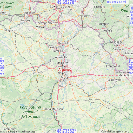
Argancy GPS coordinates[2]
49° 11' 43.548" North, 6° 12' 5.652" East
| Map corner | latitude | longitude |
|---|---|---|
| Upper-left | 49.65278°, | 5.49845° |
| Center: | 49.19543°, | 6.20157° |
| Lower-right: | 48.73382°, | 6.9047° |
| Map W x H: | 102.2×102.2 km | = 63.5×63.5mi |
| max Lat: | 51.07786° ⇑15.8% North |
| Argancy: | 49.19543° |
| min Lat: | ⇓84.2% South 41.3874° |
| min Long | Argancy | max Long |
| -5.08615° | 6.20157° | 9.52242° |
| W 89.3%⇐ | ⇒10.7% E |
Elevation
Elevation of Argancy is 175 m = 574 ft, and this is 18.7 m = 61 ft below average elevation for this country.
| Max E: |
2333 m = 7654 ft | 39% |
| Avg. | 193.7 m = 635 ft | |
| Argancy | 175 m = 574 ft | |
Min E: |
-1 m = -3 ft | 61% |
See also: France elevation on elevation.city.
Geographical zone
Argancy is located in North temperate zone (between Tropic of Cancer and the Arctic Circle). Distance of this North polar circle is 1931.2 km =1200 mi to North.| Distance of | km | miles | from Argancy |
|---|---|---|---|
| North Pole | 4537 | 2819.2 | to North |
| Arctic Circle | 1931.2 | 1200 | to North |
| Tropic Cancer | 2864.1 | 1779.7 | to South |
| Equator | 5470 | 3398.9 | to South |


Nearby cities:
15 places around Argancy: (largest is in red/bold)
• Ay-sur-Moselle
5.3 km =3.3 mi,  3°
3°
• Charly-Oradour
3.6 km =2.2 mi,  131°
131°
• Ennery
3.6 km =2.2 mi,  18°
18°
• Failly
6.1 km =3.8 mi, 134°
• Flévy
5.6 km =3.5 mi,  33°
33°
• Fèves
6.1 km =3.8 mi,  269°
269°
• Hagondange
6.5 km =4 mi,  335°
335°
• Hauconcourt
2.8 km =1.7 mi, 342°
• La Maxe
3.2 km =2 mi,  195°
195°
• Maizières-lès-Metz
3.6 km =2.2 mi,  303°
303°
• Sanry-lès-Vigy
5.9 km =3.7 mi,  104°
104°
• Semécourt
4.7 km =2.9 mi, 268°
• Talange
5 km =3.1 mi,  334°
334°
• Trémery
5.9 km =3.7 mi, 15°
• Woippy
6.1 km =3.8 mi,  216°
216°
Sources, notices
• [Note1] Compared only with cities in France existing in our database
• [Src1] Map data: © OpenStreetMap contributors (CC-BY-SA)
• [Src2] Other city data from geonames.org with taken over terms of usage.
• [Src3] Geographical zone / Annual Mean Temperature by Robert A. Rohde @ Wikipedia
