Arbusigny geodata
Arbusigny (Auvergne-Rhône-Alpes) is a populated place; located in France in Europe/Paris (GMT+2) time zone. With population of 843 people, there are 10148 cities with bigger population in this country. Compared to other cities in France, 65.2% of cities are located further ↑North; 89.5% of cities are located further ←West and 97.1% of cities have lower elevation than Arbusigny. Note1
Administrative division(s):
- Level 1: Auvergne-Rhône-Alpes
- Level 2: Haute-Savoie
- Level 3: Arrondissement de Saint-Julien-en-Genevois
- Level 4: Arbusigny


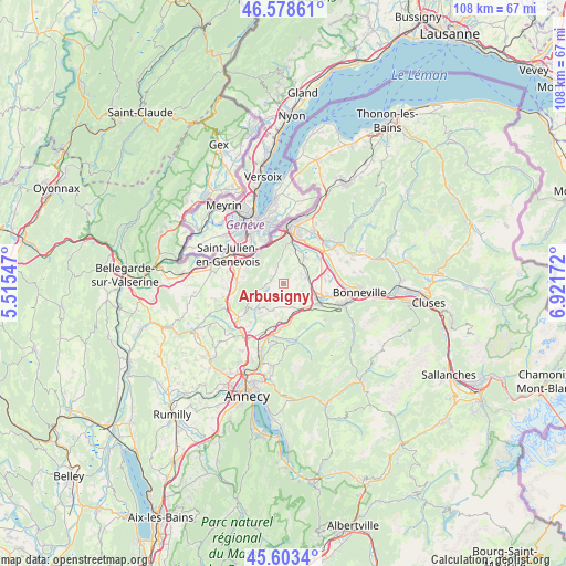
Arbusigny GPS coordinates[2]
46° 5' 35.376" North, 6° 13' 6.924" East
| Map corner | latitude | longitude |
|---|---|---|
| Upper-left | 46.57861°, | 5.51547° |
| Center: | 46.09316°, | 6.21859° |
| Lower-right: | 45.6034°, | 6.92172° |
| Map W x H: | 108.4×108.4 km | = 67.4×67.4mi |
| max Lat: | 51.07786° ⇑65.2% North |
| Arbusigny: | 46.09316° |
| min Lat: | ⇓34.8% South 41.3874° |
| min Long | Arbusigny | max Long |
| -5.08615° | 6.21859° | 9.52242° |
| W 89.5%⇐ | ⇒10.5% E |
Elevation
Elevation of Arbusigny is 736 m = 2415 ft, and this is 542.3 m = 1779 ft above average elevation for this country.
| Max E: |
2333 m = 7654 ft | 2.9% |
| Arbusigny | 736 m 2415 ft | |
| Avg. | 193.7 m = 635 ft | |
Min E: |
-1 m = -3 ft | 97.1% |
See also: France elevation on elevation.city.
Geographical zone
Arbusigny is located in North temperate zone (between Tropic of Cancer and the Arctic Circle). Distance of this North polar circle is 2276.1 km =1414.3 mi to North.| Distance of | km | miles | from Arbusigny |
|---|---|---|---|
| North Pole | 4882 | 3033.5 | to North |
| Arctic Circle | 2276.1 | 1414.3 | to North |
| Tropic Cancer | 2519.2 | 1565.4 | to South |
| Equator | 5125.1 | 3184.6 | to South |


Nearby cities:
15 places around Arbusigny: (largest is in red/bold)
• Archamps
8.4 km =5.2 mi,  301°
301°
• Arthaz-Pont-Notre-Dame
8.2 km =5.1 mi,  26°
26°
• Beaumont
7.6 km =4.7 mi,  279°
279°
• Bossey
7.9 km =4.9 mi,  323°
323°
• Collonges-sous-Salève
7.3 km =4.5 mi, 317°
• Cornier
6.2 km =3.9 mi,  90°
90°
• Etaux
6.5 km =4 mi,  114°
114°
• La Muraz
3.5 km =2.2 mi,  340°
340°
• La Roche-sur-Foron
7.1 km =4.4 mi, 110°
• Menthonnex-en-Bornes
5.8 km =3.6 mi,  217°
217°
• Monnetier-Mornex
7.5 km =4.7 mi,  352°
352°
• Pers-Jussy
4.2 km =2.6 mi,  70°
70°
• Reignier-Ésery
5.8 km =3.6 mi,  39°
39°
• Scientrier
8.6 km =5.3 mi, 72°
• Évires
6.2 km =3.9 mi,  175°
175°
Sources, notices
• [Note1] Compared only with cities in France existing in our database
• [Src1] Map data: © OpenStreetMap contributors (CC-BY-SA)
• [Src2] Other city data from geonames.org with taken over terms of usage.
• [Src3] Geographical zone / Annual Mean Temperature by Robert A. Rohde @ Wikipedia
