Alsting geodata
Alsting (Grand Est) is a populated place; located in France in Europe/Paris (GMT+2) time zone. With population of 2,744 people, there are 3570 cities with bigger population in this country. Compared to other cities in France, 83.9% of cities are located further ↓South; 94.8% of cities are located further ←West and 76.1% of cities have lower elevation than Alsting. Note1
Administrative division(s):
- Level 1: Grand Est
- Level 2: Moselle
- Level 3: Arrondissement de Forbach-Boulay-Moselle
- Level 4: Alsting


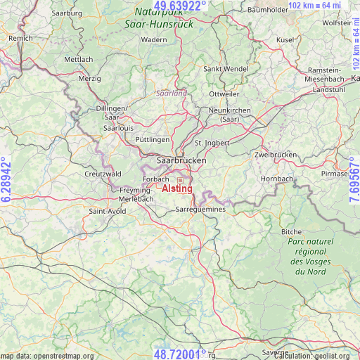
Alsting GPS coordinates[2]
49° 10' 54.3" North, 6° 59' 33.18" East
| Map corner | latitude | longitude |
|---|---|---|
| Upper-left | 49.63922°, | 6.28942° |
| Center: | 49.18175°, | 6.99255° |
| Lower-right: | 48.72001°, | 7.69567° |
| Map W x H: | 102.2×102.2 km | = 63.5×63.5mi |
| max Lat: | 51.07786° ⇑16.1% North |
| Alsting: | 49.18175° |
| min Lat: | ⇓83.9% South 41.3874° |
| min Long | Alsting | max Long |
| -5.08615° | 6.99255° | 9.52242° |
| W 94.8%⇐ | ⇒5.2% E |
Elevation
Elevation of Alsting is 257 m = 843 ft, and this is 63.3 m = 208 ft above average elevation for this country.
| Max E: |
2333 m = 7654 ft | 23.9% |
| Alsting | 257 m 843 ft | |
| Avg. | 193.7 m = 635 ft | |
Min E: |
-1 m = -3 ft | 76.1% |
See also: France elevation on elevation.city.
Geographical zone
Alsting is located in North temperate zone (between Tropic of Cancer and the Arctic Circle). Distance of this North polar circle is 1932.7 km =1200.9 mi to North.| Distance of | km | miles | from Alsting |
|---|---|---|---|
| North Pole | 4538.6 | 2820.2 | to North |
| Arctic Circle | 1932.7 | 1200.9 | to North |
| Tropic Cancer | 2862.6 | 1778.7 | to South |
| Equator | 5468.5 | 3398 | to South |


Nearby cities:
15 places around Alsting: (largest is in red/bold)
• Behren-lès-Forbach
4.1 km =2.5 mi,  250°
250°
• Blies-Guersviller
7.5 km =4.7 mi,  119°
119°
• Bousbach
4.7 km =2.9 mi,  220°
220°
• Etzling
2.5 km =1.6 mi,  264°
264°
• Forbach
7.3 km =4.5 mi,  275°
275°
• Grosbliederstroff
3.5 km =2.2 mi,  138°
138°
• Kerbach
2.6 km =1.6 mi,  229°
229°
• Lixing-lès-Rouhling
3.1 km =1.9 mi,  178°
178°
• Nousseviller-Saint-Nabor
7 km =4.3 mi,  193°
193°
• Rouhling
4.8 km =3 mi,  169°
169°
• Schœneck
6.7 km =4.2 mi,  305°
305°
• Spicheren
2.3 km =1.4 mi,  301°
301°
• Stiring-Wendel
5 km =3.1 mi, 296°
• Tenteling
7.4 km =4.6 mi,  212°
212°
• Œting
5.7 km =3.5 mi, 260°
Sources, notices
• [Note1] Compared only with cities in France existing in our database
• [Src1] Map data: © OpenStreetMap contributors (CC-BY-SA)
• [Src2] Other city data from geonames.org with taken over terms of usage.
• [Src3] Geographical zone / Annual Mean Temperature by Robert A. Rohde @ Wikipedia
