Glisy geodata
Glisy (Hauts-de-France) is a populated place; located in France in Europe/Paris (GMT+2) time zone. With population of 556 people, there are 14098 cities with bigger population in this country. Compared to other cities in France, 92.8% of cities are located further ↓South; 51.1% of cities are located further →East and 79.8% of cities have higher elevation than Glisy. Note1


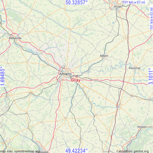
Glisy GPS coordinates[2]
49° 52' 39.288" North, 2° 23' 52.728" East
| Map corner | latitude | longitude |
|---|---|---|
| Upper-left | 50.32857°, | 1.69485° |
| Center: | 49.87758°, | 2.39798° |
| Lower-right: | 49.42234°, | 3.1011° |
| Map W x H: | 100.8×100.8 km | = 62.6×62.6mi |
| max Lat: | 51.07786° ⇑7.2% North |
| Glisy: | 49.87758° |
| min Lat: | ⇓92.8% South 41.3874° |
| min Long | Glisy | max Long |
| -5.08615° | 2.39798° | 9.52242° |
| W 48.9%⇐ | ⇒51.1% E |
Elevation
Elevation of Glisy is 55 m = 180 ft, and this is 138.7 m = 455 ft below average elevation for this country.
| Max E: |
2333 m = 7654 ft | 79.8% |
| Avg. | 193.7 m = 635 ft | |
| Glisy | 55 m = 180 ft | |
Min E: |
-1 m = -3 ft | 20.2% |
See also: France elevation on elevation.city.
Geographical zone
Glisy is located in North temperate zone (between Tropic of Cancer and the Arctic Circle). Distance of this North polar circle is 1855.3 km =1152.8 mi to North.| Distance of | km | miles | from Glisy |
|---|---|---|---|
| North Pole | 4461.2 | 2772.1 | to North |
| Arctic Circle | 1855.3 | 1152.8 | to North |
| Tropic Cancer | 2939.9 | 1826.8 | to South |
| Equator | 5545.9 | 3446.1 | to South |


Nearby cities:
15 places around Glisy: (largest is in red/bold)
• Allonville
7.4 km =4.6 mi,  340°
340°
• Amiens
7.4 km =4.6 mi,  289°
289°
• Aubigny
6.6 km =4.1 mi,  65°
65°
• Blangy-Tronville
1.8 km =1.1 mi,  84°
84°
• Boves
3.5 km =2.2 mi,  182°
182°
• Cagny
4.3 km =2.7 mi,  246°
246°
• Camon
4 km =2.5 mi, 286°
• Cottenchy
7.6 km =4.7 mi,  187°
187°
• Daours
4.4 km =2.7 mi,  48°
48°
• Longueau
2.9 km =1.8 mi,  258°
258°
• Pont-Noyelles
7.8 km =4.8 mi,  25°
25°
• Querrieu
7.2 km =4.5 mi,  19°
19°
• Rivery
6.1 km =3.8 mi,  297°
297°
• Saint-Fuscien
7.5 km =4.7 mi,  233°
233°
• Vecquemont
4.6 km =2.9 mi,  56°
56°
Sources, notices
• [Note1] Compared only with cities in France existing in our database
• [Src1] Map data: © OpenStreetMap contributors (CC-BY-SA)
• [Src2] Other city data from geonames.org with taken over terms of usage.
• [Src3] Geographical zone / Annual Mean Temperature by Robert A. Rohde @ Wikipedia
