Abeilhan geodata
Abeilhan (Occitanie) is a populated place; located in France in Europe/Paris (GMT+2) time zone. With population of 1,201 people, there are 7527 cities with bigger population in this country. Compared to other cities in France, 93.7% of cities are located further ↑North; 61.9% of cities are located further ←West and 62% of cities have higher elevation than Abeilhan. Note1
Administrative division(s):
- Level 1: Occitanie
- Level 2: Département de l'Hérault
- Level 3: Arrondissement de Béziers
- Level 4: Abeilhan


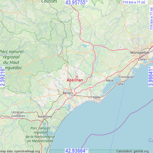
Abeilhan GPS coordinates[2]
43° 26' 57.3" North, 3° 17' 43.044" East
| Map corner | latitude | longitude |
|---|---|---|
| Upper-left | 43.95755°, | 2.59216° |
| Center: | 43.44925°, | 3.29529° |
| Lower-right: | 42.93664°, | 3.99841° |
| Map W x H: | 113.5×113.5 km | = 70.5×70.5mi |
| max Lat: | 51.07786° ⇑93.7% North |
| Abeilhan: | 43.44925° |
| min Lat: | ⇓6.3% South 41.3874° |
| min Long | Abeilhan | max Long |
| -5.08615° | 3.29529° | 9.52242° |
| W 61.9%⇐ | ⇒38.1% E |
Elevation
Elevation of Abeilhan is 97 m = 318 ft, and this is 96.7 m = 317 ft below average elevation for this country.
| Max E: |
2333 m = 7654 ft | 62% |
| Avg. | 193.7 m = 635 ft | |
| Abeilhan | 97 m = 318 ft | |
Min E: |
-1 m = -3 ft | 38% |
See also: France elevation on elevation.city.
Geographical zone
Abeilhan is located in North temperate zone (between Tropic of Cancer and the Arctic Circle). Distance of this Northern Tropic circle is 2225.2 km =1382.7 mi to South.| Distance of | km | miles | from Abeilhan |
|---|---|---|---|
| North Pole | 5176 | 3216.2 | to North |
| Arctic Circle | 2570.1 | 1597 | to North |
| Tropic Cancer | 2225.2 | 1382.7 | to South |
| Equator | 4831.1 | 3001.9 | to South |


Nearby cities:
15 places around Abeilhan: (largest is in red/bold)
• Alignan-du-Vent
4.4 km =2.7 mi,  59°
59°
• Bassan
5.4 km =3.4 mi,  217°
217°
• Caux
8.6 km =5.3 mi,  42°
42°
• Espondeilhan
2.7 km =1.7 mi,  250°
250°
• Gabian
7.3 km =4.5 mi,  346°
346°
• Lieuran-lès-Béziers
5.8 km =3.6 mi,  234°
234°
• Magalas
6.3 km =3.9 mi,  292°
292°
• Montblanc
8.4 km =5.2 mi,  136°
136°
• Pouzolles
4 km =2.5 mi,  341°
341°
• Puimisson
7.4 km =4.6 mi,  259°
259°
• Puissalicon
4.8 km =3 mi,  282°
282°
• Roujan
6.3 km =3.9 mi,  11°
11°
• Servian
2.5 km =1.6 mi,  170°
170°
• Tourbes
6.7 km =4.2 mi,  92°
92°
• Valros
6.5 km =4 mi,  120°
120°
Sources, notices
• [Note1] Compared only with cities in France existing in our database
• [Src1] Map data: © OpenStreetMap contributors (CC-BY-SA)
• [Src2] Other city data from geonames.org with taken over terms of usage.
• [Src3] Geographical zone / Annual Mean Temperature by Robert A. Rohde @ Wikipedia
