Khelvachauri geodata
Khelvachauri (Ajaria) is a seat of a second-order administrative division; located in Georgia in Asia/Tbilisi (GMT+4) time zone. In our database, there are 111 cities with bigger population. Compared to other cities in Georgia, 89.7% of cities are located further ↑North; 88% of cities are located further →East and 81.2% of cities have higher elevation than Khelvachauri. Note1


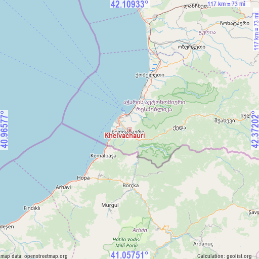
Khelvachauri GPS coordinates[2]
41° 35' 8.016" North, 41° 40' 8.004" East
| Map corner | latitude | longitude |
|---|---|---|
| Upper-left | 42.10933°, | 40.96577° |
| Center: | 41.58556°, | 41.66889° |
| Lower-right: | 41.05751°, | 42.37202° |
| Map W x H: | 117×117 km | = 72.7×72.7mi |
| max Lat: | 43.38111° ⇑89.7% North |
| Khelvachauri: | 41.58556° |
| min Lat: | ⇓10.3% South 41.21725° |
| min Long | Khelvachauri | max Long |
| 40.07944° | 41.66889° | 46.27667° |
| W 12%⇐ | ⇒88% E |
Elevation
Elevation of Khelvachauri is 33 m = 108 ft, and this is 545.8 m = 1791 ft below average elevation for this country.
| Max E: |
2223 m = 7293 ft | 81.2% |
| Avg. | 578.8 m = 1899 ft | |
| Khelvachauri | 33 m = 108 ft | |
Min E: |
1 m = 3 ft | 18.8% |
See also: Georgia elevation on elevation.city.
Geographical zone
Khelvachauri is located in North temperate zone (between Tropic of Cancer and the Arctic Circle). Distance of this Northern Tropic circle is 2018 km =1253.9 mi to South.| Distance of | km | miles | from Khelvachauri |
|---|---|---|---|
| North Pole | 5383.2 | 3345 | to North |
| Arctic Circle | 2777.3 | 1725.7 | to North |
| Tropic Cancer | 2018 | 1253.9 | to South |
| Equator | 4623.9 | 2873.2 | to South |


Nearby cities:
15 places around Khelvachauri: (largest is in red/bold)
• Akhaldaba
40.8 km =25.4 mi,  79°
79°
• Batumi
6.9 km =4.3 mi,  335°
335°
• Chakvi
16.4 km =10.2 mi,  18°
18°
• Dioknisi
60.3 km =37.5 mi,  85°
85°
• Keda
22.6 km =14 mi, 85°
• Khulo
53.2 km =33.1 mi, 83°
• Kobuleti
27.8 km =17.3 mi, 19°
• Makhinjauri
10 km =6.2 mi,  12°
12°
• Naruja
42.9 km =26.7 mi,  33°
33°
• Ochkhamuri
34.1 km =21.2 mi, 26°
• Ozurgeti
47 km =29.2 mi,  36°
36°
• P’ot’i
62.3 km =38.7 mi,  0°
0°
• Shuakhevi
43.7 km =27.2 mi, 83°
• Tsikhisdziri
21.4 km =13.3 mi, 19°
• Urek’i
46.5 km =28.9 mi, 11°
Sources, notices
• [Note1] Compared only with cities in Georgia existing in our database
• [Src1] Map data: © OpenStreetMap contributors (CC-BY-SA)
• [Src2] Other city data from geonames.org with taken over terms of usage.
• [Src3] Geographical zone / Annual Mean Temperature by Robert A. Rohde @ Wikipedia
