Kinteh Kunda geodata
Kinteh Kunda (North Bank) is a populated place; located in Gambia in Africa/Banjul (GMT+0) time zone. With population of 592 people, there are 106 cities with bigger population in this country. Compared to other cities in Gambia, 67.5% of cities are located further ↓South; 87% of cities are located further →East and 74.8% of cities have higher elevation than Kinteh Kunda. Note1


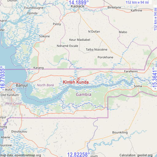
Kinteh Kunda GPS coordinates[2]
13° 30' 25.992" North, 16° 4' 1.992" West
| Map corner | latitude | longitude |
|---|---|---|
| Upper-left | 14.1899°, | -16.77035° |
| Center: | 13.50722°, | -16.06722° |
| Lower-right: | 12.82258°, | -15.3641° |
| Map W x H: | 152×152 km | = 94.4×94.4mi |
| max Lat: | 13.8° ⇑32.5% North |
| Kinteh Kunda: | 13.50722° |
| min Lat: | ⇓67.5% South 13.20194° |
| min Long | Kinteh Kunda | max Long |
| -16.73389° | -16.06722° | -13.85° |
| W 13%⇐ | ⇒87% E |
Elevation
Elevation of Kinteh Kunda is 14 m = 46 ft, and this is 7.1 m = 23 ft below average elevation for this country.
| Max E: |
49 m = 161 ft | 74.8% |
| Avg. | 21.1 m = 69 ft | |
| Kinteh Kunda | 14 m = 46 ft | |
Min E: |
1 m = 3 ft | 25.2% |
See also: Gambia elevation on elevation.city.
Geographical zone
Kinteh Kunda is located in North Torrid zone (between Equator and Tropic of Cancer). Distance of this Northern Tropic circle is 1104.1 km =686.1 mi to North.| Distance of | km | miles | from Kinteh Kunda |
|---|---|---|---|
| North Pole | 8505.2 | 5284.9 | to North |
| Arctic Circle | 5899.3 | 3665.7 | to North |
| Tropic Cancer | 1104.1 | 686.1 | to North |
| Equator | 1501.9 | 933.2 | to South |


Nearby cities:
15 places around Kinteh Kunda: (largest is in red/bold)
• Bajana
29.1 km =18.1 mi,  136°
136°
• Chilla
23.8 km =14.8 mi,  281°
281°
• Daru Rilwan
10.2 km =6.3 mi,  62°
62°
• Dobo
11.9 km =7.4 mi,  66°
66°
• Gunjur
4.6 km =2.9 mi, 67°
• Jali
20.6 km =12.8 mi,  148°
148°
• Janneh Kunda
16.1 km =10 mi,  208°
208°
• Keneba
20.6 km =12.8 mi,  164°
164°
• Kerewan
3 km =1.9 mi,  230°
230°
• Kuli Kunda
25.3 km =15.7 mi, 139°
• No Kunda
26.1 km =16.2 mi,  75°
75°
• Saba
2.2 km =1.4 mi, 62°
• Tambana
11.6 km =7.2 mi,  268°
268°
• Tankular
10.5 km =6.5 mi, 161°
• Wurokang
30.4 km =18.9 mi,  116°
116°
Sources, notices
• [Note1] Compared only with cities in Gambia existing in our database
• [Src1] Map data: © OpenStreetMap contributors (CC-BY-SA)
• [Src2] Other city data from geonames.org with taken over terms of usage.
• [Src3] Geographical zone / Annual Mean Temperature by Robert A. Rohde @ Wikipedia
