Thérmo geodata
Thérmo (West Greece) is a seat of a third-order administrative division; located in Greece in Europe/Athens (GMT+3) time zone. With population of 1,957 people, there are 529 cities with bigger population in this country. Compared to other cities in Greece, 60.4% of cities are located further ↑North; 79.3% of cities are located further →East and 83.5% of cities have lower elevation than Thérmo. Note1
Administrative division(s):
- Level 1: West Greece
- Level 2: Nomós Aitolías kai Akarnanías
- Level 3: Dimos Thermo


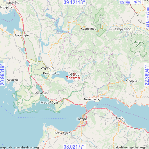
Thérmo GPS coordinates[2]
38° 34' 24.888" North, 21° 39' 58.608" East
| Map corner | latitude | longitude |
|---|---|---|
| Upper-left | 39.12118°, | 20.96316° |
| Center: | 38.57358°, | 21.66628° |
| Lower-right: | 38.02177°, | 22.36941° |
| Map W x H: | 122.2×122.2 km | = 75.9×75.9mi |
| max Lat: | 41.72048° ⇑60.4% North |
| Thérmo: | 38.57358° |
| min Lat: | ⇓39.6% South 34.8346° |
| min Long | Thérmo | max Long |
| 19.40494° | 21.66628° | 29.59361° |
| W 20.7%⇐ | ⇒79.3% E |
Elevation
Elevation of Thérmo is 349 m = 1145 ft, and this is 180.1 m = 591 ft above average elevation for this country.
| Max E: |
1439 m = 4721 ft | 16.5% |
| Thérmo | 349 m 1145 ft | |
| Avg. | 168.9 m = 554 ft | |
Min E: |
0 m = 0 ft | 83.5% |
See also: Greece elevation on elevation.city.
Geographical zone
Thérmo is located in North temperate zone (between Tropic of Cancer and the Arctic Circle). Distance of this Northern Tropic circle is 1683.1 km =1045.8 mi to South.| Distance of | km | miles | from Thérmo |
|---|---|---|---|
| North Pole | 5718.1 | 3553.1 | to North |
| Arctic Circle | 3112.2 | 1933.8 | to North |
| Tropic Cancer | 1683.1 | 1045.8 | to South |
| Equator | 4289 | 2665.1 | to South |


Nearby cities:
15 places around Thérmo: (largest is in red/bold)
• Agrínio
23.1 km =14.4 mi,  283°
283°
• Gavaloú
12.7 km =7.9 mi,  246°
246°
• Grammatikoú
14.9 km =9.3 mi, 249°
• Kainoúryion
15.9 km =9.9 mi, 282°
• Kamaroúla
20.2 km =12.6 mi,  288°
288°
• Káto Makrinoú
10.3 km =6.4 mi,  200°
200°
• Mataránga
17.7 km =11 mi, 251°
• Néa Avórani
19.4 km =12.1 mi, 281°
• Panaitólion
19.1 km =11.9 mi,  273°
273°
• Pandánassa
10.1 km =6.3 mi, 287°
• Pappadhátai
19.5 km =12.1 mi, 254°
• Paravóla
13.5 km =8.4 mi, 289°
• Zevgarákion
22.3 km =13.9 mi,  259°
259°
• Áyios Andréas
11.1 km =6.9 mi,  241°
241°
• Áyios Konstandínos
24.1 km =15 mi, 286°
Sources, notices
• [Note1] Compared only with cities in Greece existing in our database
• [Src1] Map data: © OpenStreetMap contributors (CC-BY-SA)
• [Src2] Other city data from geonames.org with taken over terms of usage.
• [Src3] Geographical zone / Annual Mean Temperature by Robert A. Rohde @ Wikipedia
