Áyios Andréas geodata
Áyios Andréas (West Greece) is a populated place; located in Greece in Europe/Athens (GMT+3) time zone. With population of 574 people, there are 1641 cities with bigger population in this country. Compared to other cities in Greece, 61.2% of cities are located further ↑North; 82% of cities are located further →East and 59.6% of cities have higher elevation than Áyios Andréas. Note1
Administrative division(s):
- Level 1: West Greece
- Level 2: Nomós Aitolías kai Akarnanías
- Level 3: Dimos Agrinio


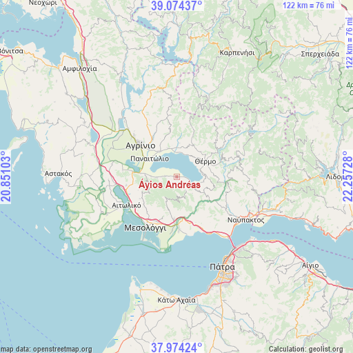
Áyios Andréas GPS coordinates[2]
38° 31' 35.076" North, 21° 33' 14.94" East
| Map corner | latitude | longitude |
|---|---|---|
| Upper-left | 39.07437°, | 20.85103° |
| Center: | 38.52641°, | 21.55415° |
| Lower-right: | 37.97424°, | 22.25728° |
| Map W x H: | 122.3×122.3 km | = 76×76mi |
| max Lat: | 41.72048° ⇑61.2% North |
| Áyios Andréas: | 38.52641° |
| min Lat: | ⇓38.8% South 34.8346° |
| min Long | Áyios Andréas | max Long |
| 19.40494° | 21.55415° | 29.59361° |
| W 18%⇐ | ⇒82% E |
Elevation
Elevation of Áyios Andréas is 51 m = 167 ft, and this is 117.9 m = 387 ft below average elevation for this country.
| Max E: |
1439 m = 4721 ft | 59.6% |
| Avg. | 168.9 m = 554 ft | |
| Áyios Andréas | 51 m = 167 ft | |
Min E: |
0 m = 0 ft | 40.4% |
See also: Greece elevation on elevation.city.
Geographical zone
Áyios Andréas is located in North temperate zone (between Tropic of Cancer and the Arctic Circle). Distance of this Northern Tropic circle is 1677.8 km =1042.5 mi to South.| Distance of | km | miles | from Áyios Andréas |
|---|---|---|---|
| North Pole | 5723.3 | 3556.3 | to North |
| Arctic Circle | 3117.4 | 1937.1 | to North |
| Tropic Cancer | 1677.8 | 1042.5 | to South |
| Equator | 4283.7 | 2661.8 | to South |


Nearby cities:
15 places around Áyios Andréas: (largest is in red/bold)
• Agrínio
16.5 km =10.3 mi,  309°
309°
• Dhokímion
17.9 km =11.1 mi,  302°
302°
• Gavaloú
1.9 km =1.2 mi,  278°
278°
• Grammatikoú
4.2 km =2.6 mi,  272°
272°
• Kainoúryion
10.4 km =6.5 mi,  326°
326°
• Kamaroúla
14.9 km =9.3 mi,  320°
320°
• Káto Makrinoú
7.6 km =4.7 mi,  125°
125°
• Mataránga
7 km =4.3 mi, 267°
• Néa Avórani
13 km =8.1 mi, 314°
• Panaitólion
11.2 km =7 mi, 304°
• Pandánassa
8.4 km =5.2 mi,  1°
1°
• Pappadhátai
9 km =5.6 mi, 271°
• Paravóla
10.2 km =6.3 mi,  343°
343°
• Thérmo
11.1 km =6.9 mi,  61°
61°
• Zevgarákion
12.2 km =7.6 mi, 275°
Sources, notices
• [Note1] Compared only with cities in Greece existing in our database
• [Src1] Map data: © OpenStreetMap contributors (CC-BY-SA)
• [Src2] Other city data from geonames.org with taken over terms of usage.
• [Src3] Geographical zone / Annual Mean Temperature by Robert A. Rohde @ Wikipedia
