Steíri geodata
Steíri (Central Greece) is a populated place; located in Greece in Europe/Athens (GMT+3) time zone. With population of 1,056 people, there are 959 cities with bigger population in this country. Compared to other cities in Greece, 63.6% of cities are located further ↑North; 54.8% of cities are located further →East and 88% of cities have lower elevation than Steíri. Note1
Administrative division(s):
- Level 1: Central Greece
- Level 2: Nomós Voiotías
- Level 3: Dimos Distomo-Arachova-Antikyra


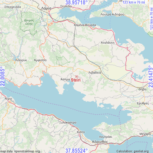
Steíri GPS coordinates[2]
38° 24' 29.916" North, 22° 42' 41.832" East
| Map corner | latitude | longitude |
|---|---|---|
| Upper-left | 38.95718°, | 22.0085° |
| Center: | 38.40831°, | 22.71162° |
| Lower-right: | 37.85524°, | 23.41475° |
| Map W x H: | 122.5×122.5 km | = 76.1×76.1mi |
| max Lat: | 41.72048° ⇑63.6% North |
| Steíri: | 38.40831° |
| min Lat: | ⇓36.4% South 34.8346° |
| min Long | Steíri | max Long |
| 19.40494° | 22.71162° | 29.59361° |
| W 45.2%⇐ | ⇒54.8% E |
Elevation
Elevation of Steíri is 454 m = 1490 ft, and this is 285.1 m = 935 ft above average elevation for this country.
| Max E: |
1439 m = 4721 ft | 12% |
| Steíri | 454 m 1490 ft | |
| Avg. | 168.9 m = 554 ft | |
Min E: |
0 m = 0 ft | 88% |
See also: Greece elevation on elevation.city.
Geographical zone
Steíri is located in North temperate zone (between Tropic of Cancer and the Arctic Circle). Distance of this Northern Tropic circle is 1664.7 km =1034.4 mi to South.| Distance of | km | miles | from Steíri |
|---|---|---|---|
| North Pole | 5736.5 | 3564.5 | to North |
| Arctic Circle | 3130.6 | 1945.3 | to North |
| Tropic Cancer | 1664.7 | 1034.4 | to South |
| Equator | 4270.6 | 2653.6 | to South |


Nearby cities:
15 places around Steíri: (largest is in red/bold)
• Agía Triáda
18.2 km =11.3 mi,  109°
109°
• Antikyra
7.4 km =4.6 mi,  247°
247°
• Aráchova
13.7 km =8.5 mi,  305°
305°
• Chairóneia
15.1 km =9.4 mi,  49°
49°
• Delphi
20.6 km =12.8 mi,  292°
292°
• Dístomo
4.5 km =2.8 mi,  300°
300°
• Eláteia
24.8 km =15.4 mi,  10°
10°
• Itéa
25.2 km =15.7 mi,  276°
276°
• Kyriáki
9 km =5.6 mi,  132°
132°
• Káto Tithoréa
22.1 km =13.7 mi,  0°
0°
• Kírra
23.4 km =14.5 mi, 275°
• Livadeiá
14.7 km =9.1 mi,  77°
77°
• Orchomenós
25.2 km =15.7 mi,  68°
68°
• Tithoréa
19.9 km =12.4 mi,  348°
348°
• Ágios Geórgios
19.3 km =12 mi,  94°
94°
Sources, notices
• [Note1] Compared only with cities in Greece existing in our database
• [Src1] Map data: © OpenStreetMap contributors (CC-BY-SA)
• [Src2] Other city data from geonames.org with taken over terms of usage.
• [Src3] Geographical zone / Annual Mean Temperature by Robert A. Rohde @ Wikipedia
