Eláteia geodata
Eláteia (Central Greece) is a populated place; located in Greece in Europe/Athens (GMT+3) time zone. With population of 2,372 people, there are 443 cities with bigger population in this country. Compared to other cities in Greece, 59.3% of cities are located further ↑North; 52.9% of cities are located further →East and 71.6% of cities have lower elevation than Eláteia. Note1
Administrative division(s):
- Level 1: Central Greece
- Level 2: Nomós Fthiótidos
- Level 3: Dimos Amfikleia-Elateia


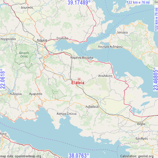
Eláteia GPS coordinates[2]
38° 37' 39.72" North, 22° 45' 53.712" East
| Map corner | latitude | longitude |
|---|---|---|
| Upper-left | 39.17489°, | 22.0618° |
| Center: | 38.6277°, | 22.76492° |
| Lower-right: | 38.0763°, | 23.46805° |
| Map W x H: | 122.2×122.2 km | = 75.9×75.9mi |
| max Lat: | 41.72048° ⇑59.3% North |
| Eláteia: | 38.6277° |
| min Lat: | ⇓40.7% South 34.8346° |
| min Long | Eláteia | max Long |
| 19.40494° | 22.76492° | 29.59361° |
| W 47.1%⇐ | ⇒52.9% E |
Elevation
Elevation of Eláteia is 178 m = 584 ft, and this is 9.1 m = 30 ft above average elevation for this country.
| Max E: |
1439 m = 4721 ft | 28.4% |
| Eláteia | 178 m 584 ft | |
| Avg. | 168.9 m = 554 ft | |
Min E: |
0 m = 0 ft | 71.6% |
See also: Greece elevation on elevation.city.
Geographical zone
Eláteia is located in North temperate zone (between Tropic of Cancer and the Arctic Circle). Distance of this Northern Tropic circle is 1689.1 km =1049.6 mi to South.| Distance of | km | miles | from Eláteia |
|---|---|---|---|
| North Pole | 5712.1 | 3549.3 | to North |
| Arctic Circle | 3106.2 | 1930.1 | to North |
| Tropic Cancer | 1689.1 | 1049.6 | to South |
| Equator | 4295 | 2668.8 | to South |


Nearby cities:
15 places around Eláteia: (largest is in red/bold)
• Amfíkleia
15.1 km =9.4 mi,  274°
274°
• Aráchova
22.8 km =14.2 mi,  223°
223°
• Atalánti
20.5 km =12.7 mi,  82°
82°
• Chairóneia
16.2 km =10.1 mi,  154°
154°
• Kainoúryion
18.7 km =11.6 mi,  349°
349°
• Kaména Voúrla
16.9 km =10.5 mi,  6°
6°
• Káto Tithoréa
5 km =3.1 mi,  243°
243°
• Livadeiá
23.4 km =14.5 mi,  155°
155°
• Mólos
22.8 km =14.2 mi,  332°
332°
• Rengínion
11.3 km =7 mi, 334°
• Tithoréa
9.7 km =6 mi, 240°
• Zéli
10.2 km =6.3 mi,  69°
69°
• Áyios Konstandínos
16.4 km =10.2 mi,  29°
29°
• Áyios Serafím
20 km =12.4 mi,  344°
344°
• Éxarkhos
16.2 km =10.1 mi,  105°
105°
Sources, notices
• [Note1] Compared only with cities in Greece existing in our database
• [Src1] Map data: © OpenStreetMap contributors (CC-BY-SA)
• [Src2] Other city data from geonames.org with taken over terms of usage.
• [Src3] Geographical zone / Annual Mean Temperature by Robert A. Rohde @ Wikipedia
