Sykiá geodata
Sykiá (Peloponnese) is a populated place; located in Greece in Europe/Athens (GMT+3) time zone. With population of 1,031 people, there are 982 cities with bigger population in this country. Compared to other cities in Greece, 91.5% of cities are located further ↑North; 52.9% of cities are located further ←West and 70.1% of cities have lower elevation than Sykiá. Note1


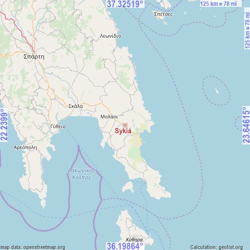
Sykiá GPS coordinates[2]
36° 45' 50.328" North, 22° 56' 34.872" East
| Map corner | latitude | longitude |
|---|---|---|
| Upper-left | 37.32519°, | 22.2399° |
| Center: | 36.76398°, | 22.94302° |
| Lower-right: | 36.19864°, | 23.64615° |
| Map W x H: | 125.3×125.3 km | = 77.9×77.9mi |
| max Lat: | 41.72048° ⇑91.5% North |
| Sykiá: | 36.76398° |
| min Lat: | ⇓8.5% South 34.8346° |
| min Long | Sykiá | max Long |
| 19.40494° | 22.94302° | 29.59361° |
| W 52.9%⇐ | ⇒47.1% E |
Elevation
Elevation of Sykiá is 167 m = 548 ft, and this is 1.9 m = 6 ft below average elevation for this country.
| Max E: |
1439 m = 4721 ft | 29.9% |
| Avg. | 168.9 m = 554 ft | |
| Sykiá | 167 m = 548 ft | |
Min E: |
0 m = 0 ft | 70.1% |
See also: Greece elevation on elevation.city.
Geographical zone
Sykiá is located in North temperate zone (between Tropic of Cancer and the Arctic Circle). Distance of this Northern Tropic circle is 1481.9 km =920.8 mi to South.| Distance of | km | miles | from Sykiá |
|---|---|---|---|
| North Pole | 5919.3 | 3678.1 | to North |
| Arctic Circle | 3313.4 | 2058.9 | to North |
| Tropic Cancer | 1481.9 | 920.8 | to South |
| Equator | 4087.8 | 2540 | to South |


Nearby cities:
15 places around Sykiá: (largest is in red/bold)
• Areópoli
51.2 km =31.8 mi,  257°
257°
• Asopós
8.7 km =5.4 mi,  244°
244°
• Elafónisos
28.6 km =17.8 mi,  173°
173°
• Geráki
33 km =20.5 mi,  320°
320°
• Géfyra
11.8 km =7.3 mi,  136°
136°
• Gýtheio
33.8 km =21 mi,  268°
268°
• Krokeés
37.7 km =23.4 mi,  290°
290°
• Káto Glykóvrysi
16.4 km =10.2 mi,  295°
295°
• Leonídio
45.4 km =28.2 mi,  350°
350°
• Moláoi
9.5 km =5.9 mi, 300°
• Poúlithra
38.7 km =24 mi, 352°
• Skála
26.4 km =16.4 mi, 291°
• Vlachiótis
23.5 km =14.6 mi, 297°
• Xirokámbion
48.8 km =30.3 mi, 296°
• Élos
23.1 km =14.4 mi, 289°
Sources, notices
• [Note1] Compared only with cities in Greece existing in our database
• [Src1] Map data: © OpenStreetMap contributors (CC-BY-SA)
• [Src2] Other city data from geonames.org with taken over terms of usage.
• [Src3] Geographical zone / Annual Mean Temperature by Robert A. Rohde @ Wikipedia
