Rentína geodata
Rentína (Thessaly) is a populated place; located in Greece in Europe/Athens (GMT+3) time zone. With population of 828 people, there are 1232 cities with bigger population in this country. Compared to other cities in Greece, 53.7% of cities are located further ↑North; 72.7% of cities are located further →East and 98.7% of cities have lower elevation than Rentína. Note1


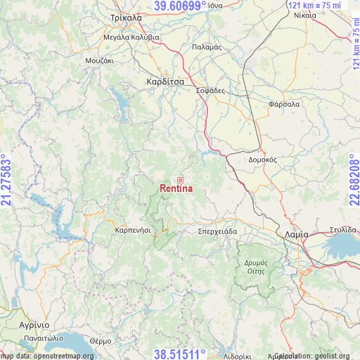
Rentína GPS coordinates[2]
39° 3' 47.376" North, 21° 58' 44.22" East
| Map corner | latitude | longitude |
|---|---|---|
| Upper-left | 39.60699°, | 21.27583° |
| Center: | 39.06316°, | 21.97895° |
| Lower-right: | 38.51511°, | 22.68208° |
| Map W x H: | 121.4×121.4 km | = 75.4×75.4mi |
| max Lat: | 41.72048° ⇑53.7% North |
| Rentína: | 39.06316° |
| min Lat: | ⇓46.3% South 34.8346° |
| min Long | Rentína | max Long |
| 19.40494° | 21.97895° | 29.59361° |
| W 27.3%⇐ | ⇒72.7% E |
Elevation
Elevation of Rentína is 898 m = 2946 ft, and this is 729.1 m = 2392 ft above average elevation for this country.
| Max E: |
1439 m = 4721 ft | 1.3% |
| Rentína | 898 m 2946 ft | |
| Avg. | 168.9 m = 554 ft | |
Min E: |
0 m = 0 ft | 98.7% |
See also: Greece elevation on elevation.city.
Geographical zone
Rentína is located in North temperate zone (between Tropic of Cancer and the Arctic Circle). Distance of this Northern Tropic circle is 1737.5 km =1079.6 mi to South.| Distance of | km | miles | from Rentína |
|---|---|---|---|
| North Pole | 5663.6 | 3519.2 | to North |
| Arctic Circle | 3057.8 | 1900 | to North |
| Tropic Cancer | 1737.5 | 1079.6 | to South |
| Equator | 4343.4 | 2698.9 | to South |


Nearby cities:
15 places around Rentína: (largest is in red/bold)
• Anávra
17.2 km =10.7 mi,  34°
34°
• Domokós
28.6 km =17.8 mi,  75°
75°
• Ekkára
21.4 km =13.3 mi,  61°
61°
• Fourná
9 km =5.6 mi,  267°
267°
• Ftéri
19 km =11.8 mi,  162°
162°
• Kallifóni
23.8 km =14.8 mi,  356°
356°
• Kallíthiro
25 km =15.5 mi,  345°
345°
• Karpenísi
22.9 km =14.2 mi,  222°
222°
• Makrakómi
17.9 km =11.1 mi,  138°
138°
• Omvriakí
25.6 km =15.9 mi, 80°
• Palioúri
17.4 km =10.8 mi,  0°
0°
• Roússo
28.4 km =17.6 mi, 346°
• Spercheiáda
21.7 km =13.5 mi, 143°
• Zaḯmi
26.5 km =16.5 mi, 352°
• Ágios Geórgios
28.7 km =17.8 mi,  334°
334°
Sources, notices
• [Note1] Compared only with cities in Greece existing in our database
• [Src1] Map data: © OpenStreetMap contributors (CC-BY-SA)
• [Src2] Other city data from geonames.org with taken over terms of usage.
• [Src3] Geographical zone / Annual Mean Temperature by Robert A. Rohde @ Wikipedia
