Neméa geodata
Neméa (Peloponnese) is a seat of a third-order administrative division; located in Greece in Europe/Athens (GMT+3) time zone. With population of 3,853 people, there are 287 cities with bigger population in this country. Compared to other cities in Greece, 79.4% of cities are located further ↑North; 56% of cities are located further →East and 81.5% of cities have lower elevation than Neméa. Note1


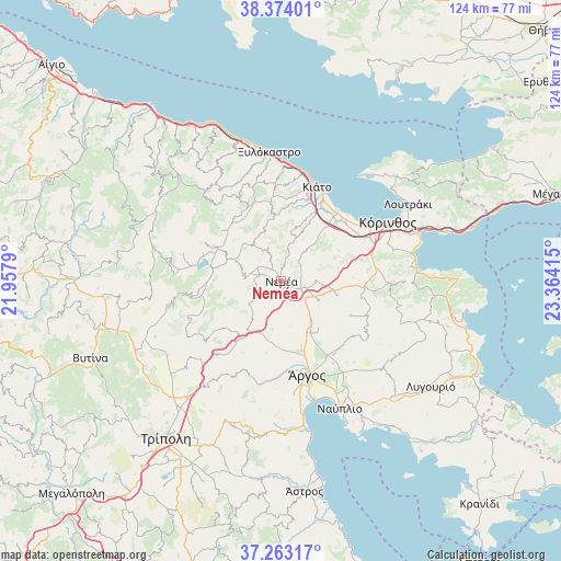
Neméa GPS coordinates[2]
37° 49' 14.448" North, 22° 39' 39.672" East
| Map corner | latitude | longitude |
|---|---|---|
| Upper-left | 38.37401°, | 21.9579° |
| Center: | 37.82068°, | 22.66102° |
| Lower-right: | 37.26317°, | 23.36415° |
| Map W x H: | 123.5×123.5 km | = 76.7×76.7mi |
| max Lat: | 41.72048° ⇑79.4% North |
| Neméa: | 37.82068° |
| min Lat: | ⇓20.6% South 34.8346° |
| min Long | Neméa | max Long |
| 19.40494° | 22.66102° | 29.59361° |
| W 44%⇐ | ⇒56% E |
Elevation
Elevation of Neméa is 309 m = 1014 ft, and this is 140.1 m = 460 ft above average elevation for this country.
| Max E: |
1439 m = 4721 ft | 18.5% |
| Neméa | 309 m 1014 ft | |
| Avg. | 168.9 m = 554 ft | |
Min E: |
0 m = 0 ft | 81.5% |
See also: Greece elevation on elevation.city.
Geographical zone
Neméa is located in North temperate zone (between Tropic of Cancer and the Arctic Circle). Distance of this Northern Tropic circle is 1599.3 km =993.8 mi to South.| Distance of | km | miles | from Neméa |
|---|---|---|---|
| North Pole | 5801.8 | 3605.1 | to North |
| Arctic Circle | 3195.9 | 1985.8 | to North |
| Tropic Cancer | 1599.3 | 993.8 | to South |
| Equator | 4205.3 | 2613.1 | to South |


Nearby cities:
15 places around Neméa: (largest is in red/bold)
• ArchaÍes Kleonés
7.9 km =4.9 mi,  88°
88°
• Boláti
18.9 km =11.7 mi,  37°
37°
• Fíkhtion
12.4 km =7.7 mi,  153°
153°
• Khiliomódhi
18.4 km =11.4 mi, 93°
• Klénia
18 km =11.2 mi,  101°
101°
• Koutsopódi
15.9 km =9.9 mi,  163°
163°
• Krionérion
16 km =9.9 mi,  352°
352°
• Krínes
18.4 km =11.4 mi,  28°
28°
• Poullítsa
18.2 km =11.3 mi, 32°
• Sikyón
18.8 km =11.7 mi,  17°
17°
• Stimánga
10.5 km =6.5 mi, 19°
• Vokhaïkó
18.3 km =11.4 mi, 38°
• Zevgolateió
17.5 km =10.9 mi, 44°
• Áyios Vasílios
12.2 km =7.6 mi, 102°
• Ínachos
19.1 km =11.9 mi, 155°
Sources, notices
• [Note1] Compared only with cities in Greece existing in our database
• [Src1] Map data: © OpenStreetMap contributors (CC-BY-SA)
• [Src2] Other city data from geonames.org with taken over terms of usage.
• [Src3] Geographical zone / Annual Mean Temperature by Robert A. Rohde @ Wikipedia
