Ágios Nikólaos geodata
Ágios Nikólaos (West Greece) is a populated place; located in Greece in Europe/Athens (GMT+3) time zone. With population of 738 people, there are 1351 cities with bigger population in this country. Compared to other cities in Greece, 56.3% of cities are located further ↑North; 93.8% of cities are located further →East and 89.2% of cities have higher elevation than Ágios Nikólaos. Note1
Administrative division(s):
- Level 1: West Greece
- Level 2: Nomós Aitolías kai Akarnanías
- Level 3: Dimos Aktio-Vonitsa


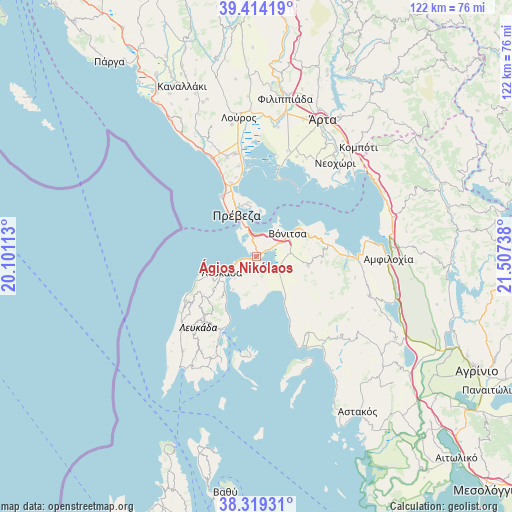
Ágios Nikólaos GPS coordinates[2]
38° 52' 7.896" North, 20° 48' 15.3" East
| Map corner | latitude | longitude |
|---|---|---|
| Upper-left | 39.41419°, | 20.10113° |
| Center: | 38.86886°, | 20.80425° |
| Lower-right: | 38.31931°, | 21.50738° |
| Map W x H: | 121.7×121.7 km | = 75.6×75.6mi |
| max Lat: | 41.72048° ⇑56.3% North |
| Ágios Nikólaos: | 38.86886° |
| min Lat: | ⇓43.7% South 34.8346° |
| min Long | Ágios Nikólao | max Long |
| 19.40494° | 20.80425° | 29.59361° |
| W 6.2%⇐ | ⇒93.8% E |
Elevation
Elevation of Ágios Nikólaos is 9 m = 30 ft, and this is 159.9 m = 525 ft below average elevation for this country.
| Max E: |
1439 m = 4721 ft | 89.2% |
| Avg. | 168.9 m = 554 ft | |
| Ágios Nikólaos | 9 m = 30 ft | |
Min E: |
0 m = 0 ft | 10.8% |
See also: Greece elevation on elevation.city.
Geographical zone
Ágios Nikólaos is located in North temperate zone (between Tropic of Cancer and the Arctic Circle). Distance of this Northern Tropic circle is 1715.9 km =1066.2 mi to South.| Distance of | km | miles | from Ágios Nikólaos |
|---|---|---|---|
| North Pole | 5685.2 | 3532.6 | to North |
| Arctic Circle | 3079.4 | 1913.4 | to North |
| Tropic Cancer | 1715.9 | 1066.2 | to South |
| Equator | 4321.8 | 2685.4 | to South |


Nearby cities:
15 places around Ágios Nikólaos: (largest is in red/bold)
• Apólpaina
11.8 km =7.3 mi,  239°
239°
• Kariótai
11 km =6.8 mi,  224°
224°
• Lazaráta
15.6 km =9.7 mi,  229°
229°
• Lefkáda
9.6 km =6 mi, 243°
• Ligia
11.7 km =7.3 mi, 218°
• Monastiráki
12.3 km =7.6 mi,  99°
99°
• Mýtikas
16.6 km =10.3 mi,  329°
329°
• Nikiána
14.2 km =8.8 mi,  211°
211°
• Paliámpela
13.6 km =8.5 mi,  69°
69°
• Plagiá
9.5 km =5.9 mi, 215°
• Préveza
10.8 km =6.7 mi, 334°
• Pálairos
11.7 km =7.3 mi,  144°
144°
• Thýrio
15.4 km =9.6 mi, 95°
• Tsoukaládhes
13.9 km =8.6 mi,  247°
247°
• Vónitsa
8.9 km =5.5 mi,  53°
53°
Sources, notices
• [Note1] Compared only with cities in Greece existing in our database
• [Src1] Map data: © OpenStreetMap contributors (CC-BY-SA)
• [Src2] Other city data from geonames.org with taken over terms of usage.
• [Src3] Geographical zone / Annual Mean Temperature by Robert A. Rohde @ Wikipedia
