Apólpaina geodata
Apólpaina (Ionian Islands) is a populated place; located in Greece in Europe/Athens (GMT+3) time zone. With population of 819 people, there are 1248 cities with bigger population in this country. Compared to other cities in Greece, 57.1% of cities are located further ↑North; 95.6% of cities are located further →East and 51.7% of cities have higher elevation than Apólpaina. Note1


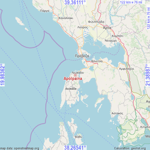
Apólpaina GPS coordinates[2]
38° 48' 55.332" North, 20° 41' 12.264" East
| Map corner | latitude | longitude |
|---|---|---|
| Upper-left | 39.36111°, | 19.98362° |
| Center: | 38.81537°, | 20.68674° |
| Lower-right: | 38.26541°, | 21.38987° |
| Map W x H: | 121.8×121.8 km | = 75.7×75.7mi |
| max Lat: | 41.72048° ⇑57.1% North |
| Apólpaina: | 38.81537° |
| min Lat: | ⇓42.9% South 34.8346° |
| min Long | Apólpaina | max Long |
| 19.40494° | 20.68674° | 29.59361° |
| W 4.4%⇐ | ⇒95.6% E |
Elevation
Elevation of Apólpaina is 75 m = 246 ft, and this is 93.9 m = 308 ft below average elevation for this country.
| Max E: |
1439 m = 4721 ft | 51.7% |
| Avg. | 168.9 m = 554 ft | |
| Apólpaina | 75 m = 246 ft | |
Min E: |
0 m = 0 ft | 48.3% |
See also: Greece elevation on elevation.city.
Geographical zone
Apólpaina is located in North temperate zone (between Tropic of Cancer and the Arctic Circle). Distance of this Northern Tropic circle is 1709.9 km =1062.5 mi to South.| Distance of | km | miles | from Apólpaina |
|---|---|---|---|
| North Pole | 5691.2 | 3536.3 | to North |
| Arctic Circle | 3085.3 | 1917.1 | to North |
| Tropic Cancer | 1709.9 | 1062.5 | to South |
| Equator | 4315.9 | 2681.8 | to South |


Nearby cities:
15 places around Apólpaina: (largest is in red/bold)
• Kariótai
3.1 km =1.9 mi,  127°
127°
• Karyá
7.1 km =4.4 mi,  207°
207°
• Lazaráta
4.5 km =2.8 mi,  201°
201°
• Lefkáda
2.3 km =1.4 mi,  42°
42°
• Ligia
4.2 km =2.6 mi,  138°
138°
• Monastiráki
22.7 km =14.1 mi,  80°
80°
• Mýtikas
20.3 km =12.6 mi,  4°
4°
• Nidhríon
11.9 km =7.4 mi,  168°
168°
• Nikiána
6.7 km =4.2 mi,  155°
155°
• Plagiá
5 km =3.1 mi,  111°
111°
• Préveza
16.6 km =10.3 mi,  19°
19°
• Pálairos
17.3 km =10.7 mi,  102°
102°
• Tsoukaládhes
2.8 km =1.7 mi,  284°
284°
• Vónitsa
20.6 km =12.8 mi,  56°
56°
• Ágios Nikólaos
11.8 km =7.3 mi, 59°
Sources, notices
• [Note1] Compared only with cities in Greece existing in our database
• [Src1] Map data: © OpenStreetMap contributors (CC-BY-SA)
• [Src2] Other city data from geonames.org with taken over terms of usage.
• [Src3] Geographical zone / Annual Mean Temperature by Robert A. Rohde @ Wikipedia
