Ágioi Theódoroi geodata
Ágioi Theódoroi (Peloponnese) is a populated place; located in Greece in Europe/Athens (GMT+3) time zone. With population of 4,643 people, there are 253 cities with bigger population in this country. Compared to other cities in Greece, 77.2% of cities are located further ↑North; 57.6% of cities are located further ←West and 87.7% of cities have higher elevation than Ágioi Theódoroi. Note1
Administrative division(s):
- Level 1: Peloponnese
- Level 2: Nomós Korinthías
- Level 3: Dimos Loutraki-Agioi Theodoroi


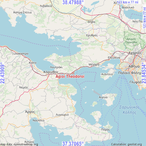
Ágioi Theódoroi GPS coordinates[2]
37° 55' 38.496" North, 23° 8' 31.956" East
| Map corner | latitude | longitude |
|---|---|---|
| Upper-left | 38.47988°, | 22.43909° |
| Center: | 37.92736°, | 23.14221° |
| Lower-right: | 37.37065°, | 23.84534° |
| Map W x H: | 123.3×123.3 km | = 76.6×76.6mi |
| max Lat: | 41.72048° ⇑77.2% North |
| Ágioi Theódoroi: | 37.92736° |
| min Lat: | ⇓22.8% South 34.8346° |
| min Long | Ágioi Theódor | max Long |
| 19.40494° | 23.14221° | 29.59361° |
| W 57.6%⇐ | ⇒42.4% E |
Elevation
Elevation of Ágioi Theódoroi is 10 m = 33 ft, and this is 158.9 m = 521 ft below average elevation for this country.
| Max E: |
1439 m = 4721 ft | 87.7% |
| Avg. | 168.9 m = 554 ft | |
| Ágioi Theódoroi | 10 m = 33 ft | |
Min E: |
0 m = 0 ft | 12.3% |
See also: Greece elevation on elevation.city.
Geographical zone
Ágioi Theódoroi is located in North temperate zone (between Tropic of Cancer and the Arctic Circle). Distance of this Northern Tropic circle is 1611.2 km =1001.2 mi to South.| Distance of | km | miles | from Ágioi Theódoroi |
|---|---|---|---|
| North Pole | 5789.9 | 3597.7 | to North |
| Arctic Circle | 3184 | 1978.4 | to North |
| Tropic Cancer | 1611.2 | 1001.2 | to South |
| Equator | 4217.1 | 2620.4 | to South |


Nearby cities:
15 places around Ágioi Theódoroi: (largest is in red/bold)
• Archaío Limáni
21.8 km =13.5 mi,  270°
270°
• Examília
19.1 km =11.9 mi,  259°
259°
• Isthmía
12.2 km =7.6 mi, 262°
• Kinéta
7.7 km =4.8 mi,  53°
53°
• Kyrás Vrýsi
13.8 km =8.6 mi, 263°
• Káto Almyrí
15 km =9.3 mi,  234°
234°
• Káto Examília
17.9 km =11.1 mi, 262°
• Kórinthos
16.8 km =10.4 mi, 274°
• Loutrá Oraías Elénis
14.6 km =9.1 mi,  241°
241°
• Loutráki
15.5 km =9.6 mi,  291°
291°
• Mégara
19.1 km =11.9 mi,  66°
66°
• Perachóra
20.4 km =12.7 mi,  304°
304°
• Páchi
20 km =12.4 mi, 74°
• Sofikón
16.8 km =10.4 mi,  208°
208°
• Xilokériza
18.2 km =11.3 mi,  254°
254°
Sources, notices
• [Note1] Compared only with cities in Greece existing in our database
• [Src1] Map data: © OpenStreetMap contributors (CC-BY-SA)
• [Src2] Other city data from geonames.org with taken over terms of usage.
• [Src3] Geographical zone / Annual Mean Temperature by Robert A. Rohde @ Wikipedia
