Páchi geodata
Páchi (Attica) is a populated place; located in Greece in Europe/Athens (GMT+3) time zone. With population of 542 people, there are 1711 cities with bigger population in this country. Compared to other cities in Greece, 74.7% of cities are located further ↑North; 61.5% of cities are located further ←West and 74.1% of cities have higher elevation than Páchi. Note1
Administrative division(s):
- Level 1: Attica
- Level 2: Nomarchía Dytikís Attikís
- Level 3: Dimos Megara


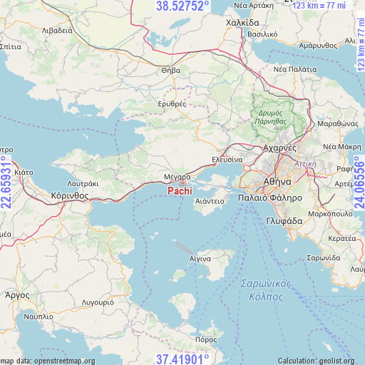
Páchi GPS coordinates[2]
37° 58' 31.296" North, 23° 21' 44.748" East
| Map corner | latitude | longitude |
|---|---|---|
| Upper-left | 38.52752°, | 22.65931° |
| Center: | 37.97536°, | 23.36243° |
| Lower-right: | 37.41901°, | 24.06556° |
| Map W x H: | 123.3×123.3 km | = 76.6×76.6mi |
| max Lat: | 41.72048° ⇑74.7% North |
| Páchi: | 37.97536° |
| min Lat: | ⇓25.3% South 34.8346° |
| min Long | Páchi | max Long |
| 19.40494° | 23.36243° | 29.59361° |
| W 61.5%⇐ | ⇒38.5% E |
Elevation
Elevation of Páchi is 25 m = 82 ft, and this is 143.9 m = 472 ft below average elevation for this country.
| Max E: |
1439 m = 4721 ft | 74.1% |
| Avg. | 168.9 m = 554 ft | |
| Páchi | 25 m = 82 ft | |
Min E: |
0 m = 0 ft | 25.9% |
See also: Greece elevation on elevation.city.
Geographical zone
Páchi is located in North temperate zone (between Tropic of Cancer and the Arctic Circle). Distance of this Northern Tropic circle is 1616.5 km =1004.4 mi to South.| Distance of | km | miles | from Páchi |
|---|---|---|---|
| North Pole | 5784.6 | 3594.4 | to North |
| Arctic Circle | 3178.7 | 1975.2 | to North |
| Tropic Cancer | 1616.5 | 1004.4 | to South |
| Equator | 4222.5 | 2623.7 | to South |


Nearby cities:
15 places around Páchi: (largest is in red/bold)
• Aiánteio
10.4 km =6.5 mi,  125°
125°
• Ampelákia
14.8 km =9.2 mi,  100°
100°
• Elefsína
17.4 km =10.8 mi,  65°
65°
• Kinéta
13.1 km =8.1 mi,  266°
266°
• Lákka Kalogírou
2.9 km =1.8 mi,  44°
44°
• Magoúla
18.1 km =11.2 mi,  50°
50°
• Mándra
15.8 km =9.8 mi, 49°
• Mégara
2.7 km =1.7 mi,  321°
321°
• Néa Péramos
6.4 km =4 mi,  57°
57°
• Néa Zoí
16.1 km =10 mi, 41°
• Pérama
18.4 km =11.4 mi,  92°
92°
• Salamína
11.8 km =7.3 mi, 95°
• Selínia
15.5 km =9.6 mi,  107°
107°
• Vlycháda
8.7 km =5.4 mi, 48°
• Ágioi Theódoroi
20 km =12.4 mi,  254°
254°
Sources, notices
• [Note1] Compared only with cities in Greece existing in our database
• [Src1] Map data: © OpenStreetMap contributors (CC-BY-SA)
• [Src2] Other city data from geonames.org with taken over terms of usage.
• [Src3] Geographical zone / Annual Mean Temperature by Robert A. Rohde @ Wikipedia
