Mégara geodata
Mégara (Attica) is a seat of a third-order administrative division; located in Greece in Europe/Athens (GMT+3) time zone. With population of 23,456 people, there are 81 cities with bigger population in this country. Compared to other cities in Greece, 73.8% of cities are located further ↑North; 61.2% of cities are located further ←West and 67.6% of cities have higher elevation than Mégara. Note1
Administrative division(s):
- Level 1: Attica
- Level 2: Nomarchía Dytikís Attikís
- Level 3: Dimos Megara


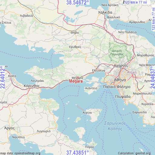
Mégara GPS coordinates[2]
37° 59' 40.956" North, 23° 20' 35.664" East
| Map corner | latitude | longitude |
|---|---|---|
| Upper-left | 38.54672°, | 22.64012° |
| Center: | 37.99471°, | 23.34324° |
| Lower-right: | 37.43851°, | 24.04637° |
| Map W x H: | 123.2×123.2 km | = 76.6×76.6mi |
| max Lat: | 41.72048° ⇑73.8% North |
| Mégara: | 37.99471° |
| min Lat: | ⇓26.2% South 34.8346° |
| min Long | Mégara | max Long |
| 19.40494° | 23.34324° | 29.59361° |
| W 61.2%⇐ | ⇒38.8% E |
Elevation
Elevation of Mégara is 35 m = 115 ft, and this is 133.9 m = 439 ft below average elevation for this country.
| Max E: |
1439 m = 4721 ft | 67.6% |
| Avg. | 168.9 m = 554 ft | |
| Mégara | 35 m = 115 ft | |
Min E: |
0 m = 0 ft | 32.4% |
See also: Greece elevation on elevation.city.
Geographical zone
Mégara is located in North temperate zone (between Tropic of Cancer and the Arctic Circle). Distance of this Northern Tropic circle is 1618.7 km =1005.8 mi to South.| Distance of | km | miles | from Mégara |
|---|---|---|---|
| North Pole | 5782.4 | 3593 | to North |
| Arctic Circle | 3176.6 | 1973.8 | to North |
| Tropic Cancer | 1618.7 | 1005.8 | to South |
| Equator | 4224.6 | 2625 | to South |


Nearby cities:
15 places around Mégara: (largest is in red/bold)
• Aiánteio
13 km =8.1 mi,  128°
128°
• Ampelákia
16.9 km =10.5 mi,  106°
106°
• Elefsína
18.2 km =11.3 mi,  73°
73°
• Kinéta
11.7 km =7.3 mi,  255°
255°
• Lákka Kalogírou
3.7 km =2.3 mi,  91°
91°
• Magoúla
18.2 km =11.3 mi,  58°
58°
• Mándra
15.9 km =9.9 mi, 59°
• Néa Péramos
7.2 km =4.5 mi,  79°
79°
• Néa Zoí
15.8 km =9.8 mi,  51°
51°
• Páchi
2.7 km =1.7 mi,  141°
141°
• Salamína
13.9 km =8.6 mi,  104°
104°
• Selínia
17.9 km =11.1 mi, 112°
• Vlycháda
8.9 km =5.5 mi, 66°
• Vília
19.2 km =11.9 mi,  358°
358°
• Ágioi Theódoroi
19.1 km =11.9 mi,  246°
246°
In other languages:
- In Spanish: Megara
- In France: Mégare
- In German: Megara
- In Italian: Megara
- In Russian: Мегара
Sources, notices
• [Note1] Compared only with cities in Greece existing in our database
• [Src1] Map data: © OpenStreetMap contributors (CC-BY-SA)
• [Src2] Other city data from geonames.org with taken over terms of usage.
• [Src3] Geographical zone / Annual Mean Temperature by Robert A. Rohde @ Wikipedia
