Agiá geodata
Agiá (Thessaly) is a seat of a third-order administrative division; located in Greece in Europe/Athens (GMT+3) time zone. With population of 2,827 people, there are 371 cities with bigger population in this country. Compared to other cities in Greece, 63.2% of cities are located further ↓South; 53.2% of cities are located further →East and 73.4% of cities have lower elevation than Agiá. Note1


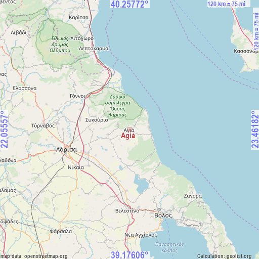
Agiá GPS coordinates[2]
39° 43' 8.436" North, 22° 45' 31.284" East
| Map corner | latitude | longitude |
|---|---|---|
| Upper-left | 40.25772°, | 22.05557° |
| Center: | 39.71901°, | 22.75869° |
| Lower-right: | 39.17606°, | 23.46182° |
| Map W x H: | 120.3×120.3 km | = 74.8×74.8mi |
| max Lat: | 41.72048° ⇑36.8% North |
| Agiá: | 39.71901° |
| min Lat: | ⇓63.2% South 34.8346° |
| min Long | Agiá | max Long |
| 19.40494° | 22.75869° | 29.59361° |
| W 46.8%⇐ | ⇒53.2% E |
Elevation
Elevation of Agiá is 192 m = 630 ft, and this is 23.1 m = 76 ft above average elevation for this country.
| Max E: |
1439 m = 4721 ft | 26.6% |
| Agiá | 192 m 630 ft | |
| Avg. | 168.9 m = 554 ft | |
Min E: |
0 m = 0 ft | 73.4% |
See also: Greece elevation on elevation.city.
Geographical zone
Agiá is located in North temperate zone (between Tropic of Cancer and the Arctic Circle). Distance of this Northern Tropic circle is 1810.4 km =1124.9 mi to South.| Distance of | km | miles | from Agiá |
|---|---|---|---|
| North Pole | 5590.7 | 3473.9 | to North |
| Arctic Circle | 2984.8 | 1854.7 | to North |
| Tropic Cancer | 1810.4 | 1124.9 | to South |
| Equator | 4416.3 | 2744.2 | to South |


Nearby cities:
15 places around Agiá: (largest is in red/bold)
• Arméni
26.2 km =16.3 mi,  191°
191°
• Chálki
25.1 km =15.6 mi,  228°
228°
• Eláteia
21.4 km =13.3 mi,  298°
298°
• Kanália
26.8 km =16.7 mi,  155°
155°
• Makrychóri
25.2 km =15.7 mi,  290°
290°
• Melívoia
4.7 km =2.9 mi,  42°
42°
• Omólio
22 km =13.7 mi,  333°
333°
• Platýkampos
22.4 km =13.9 mi,  239°
239°
• Pournári
16.9 km =10.5 mi, 291°
• Pyrgetós
26.3 km =16.3 mi, 327°
• Rapsáni
27.1 km =16.8 mi,  318°
318°
• Stefanovíkeio
28.4 km =17.6 mi,  182°
182°
• Stómio
16.7 km =10.4 mi,  352°
352°
• Sykoúrio
15.9 km =9.9 mi, 286°
• Óssa
15.7 km =9.8 mi,  281°
281°
Sources, notices
• [Note1] Compared only with cities in Greece existing in our database
• [Src1] Map data: © OpenStreetMap contributors (CC-BY-SA)
• [Src2] Other city data from geonames.org with taken over terms of usage.
• [Src3] Geographical zone / Annual Mean Temperature by Robert A. Rohde @ Wikipedia
