Aigáni geodata
Aigáni (Thessaly) is a populated place; located in Greece in Europe/Athens (GMT+3) time zone. With population of 694 people, there are 1420 cities with bigger population in this country. Compared to other cities in Greece, 66.2% of cities are located further ↓South; 56.8% of cities are located further →East and 80.5% of cities have lower elevation than Aigáni. Note1


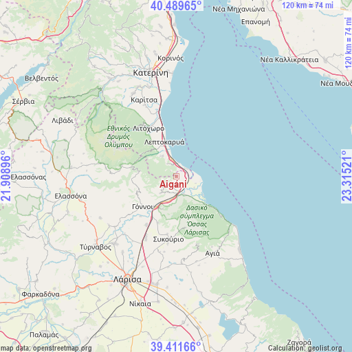
Aigáni GPS coordinates[2]
39° 57' 10.008" North, 22° 36' 43.488" East
| Map corner | latitude | longitude |
|---|---|---|
| Upper-left | 40.48965°, | 21.90896° |
| Center: | 39.95278°, | 22.61208° |
| Lower-right: | 39.41166°, | 23.31521° |
| Map W x H: | 119.9×119.9 km | = 74.5×74.5mi |
| max Lat: | 41.72048° ⇑33.8% North |
| Aigáni: | 39.95278° |
| min Lat: | ⇓66.2% South 34.8346° |
| min Long | Aigáni | max Long |
| 19.40494° | 22.61208° | 29.59361° |
| W 43.2%⇐ | ⇒56.8% E |
Elevation
Elevation of Aigáni is 283 m = 928 ft, and this is 114.1 m = 374 ft above average elevation for this country.
| Max E: |
1439 m = 4721 ft | 19.5% |
| Aigáni | 283 m 928 ft | |
| Avg. | 168.9 m = 554 ft | |
Min E: |
0 m = 0 ft | 80.5% |
See also: Greece elevation on elevation.city.
Geographical zone
Aigáni is located in North temperate zone (between Tropic of Cancer and the Arctic Circle). Distance of this Northern Tropic circle is 1836.4 km =1141.1 mi to South.| Distance of | km | miles | from Aigáni |
|---|---|---|---|
| North Pole | 5564.7 | 3457.7 | to North |
| Arctic Circle | 2958.8 | 1838.5 | to North |
| Tropic Cancer | 1836.4 | 1141.1 | to South |
| Equator | 4442.3 | 2760.3 | to South |


Nearby cities:
15 places around Aigáni: (largest is in red/bold)
• Díon
26.6 km =16.5 mi,  335°
335°
• Eláteia
17 km =10.6 mi,  201°
201°
• Gónnoi
15.4 km =9.6 mi,  228°
228°
• Leptokaryá
12.7 km =7.9 mi, 340°
• Litóchoro
19.1 km =11.9 mi,  329°
329°
• Makrychóri
20.2 km =12.6 mi,  212°
212°
• Néoi Póroi
4.2 km =2.6 mi,  49°
49°
• Omólio
6.9 km =4.3 mi,  158°
158°
• Pournári
19.9 km =12.4 mi,  188°
188°
• Pyrgetós
4.1 km =2.5 mi, 202°
• Rapsáni
7.8 km =4.8 mi,  223°
223°
• Skotína
8.6 km =5.3 mi,  323°
323°
• Stómio
13.9 km =8.6 mi,  132°
132°
• Sykoúrio
21.7 km =13.5 mi, 187°
• Óssa
23.1 km =14.4 mi, 187°
Sources, notices
• [Note1] Compared only with cities in Greece existing in our database
• [Src1] Map data: © OpenStreetMap contributors (CC-BY-SA)
• [Src2] Other city data from geonames.org with taken over terms of usage.
• [Src3] Geographical zone / Annual Mean Temperature by Robert A. Rohde @ Wikipedia
