Skotína geodata
Skotína (Central Macedonia) is a populated place; located in Greece in Europe/Athens (GMT+3) time zone. With population of 953 people, there are 1070 cities with bigger population in this country. Compared to other cities in Greece, 66.8% of cities are located further ↓South; 58.3% of cities are located further →East and 54.8% of cities have lower elevation than Skotína. Note1
Administrative division(s):
- Level 1: Central Macedonia
- Level 2: Nomós Pierías
- Level 3: Dimos Dio-Olympos


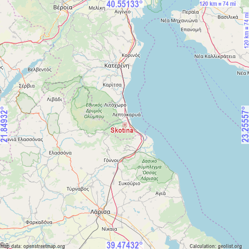
Skotína GPS coordinates[2]
40° 0' 53.82" North, 22° 33' 8.784" East
| Map corner | latitude | longitude |
|---|---|---|
| Upper-left | 40.55133°, | 21.84932° |
| Center: | 40.01495°, | 22.55244° |
| Lower-right: | 39.47432°, | 23.25557° |
| Map W x H: | 119.8×119.8 km | = 74.4×74.4mi |
| max Lat: | 41.72048° ⇑33.2% North |
| Skotína: | 40.01495° |
| min Lat: | ⇓66.8% South 34.8346° |
| min Long | Skotína | max Long |
| 19.40494° | 22.55244° | 29.59361° |
| W 41.7%⇐ | ⇒58.3% E |
Elevation
Elevation of Skotína is 98 m = 322 ft, and this is 70.9 m = 233 ft below average elevation for this country.
| Max E: |
1439 m = 4721 ft | 45.2% |
| Avg. | 168.9 m = 554 ft | |
| Skotína | 98 m = 322 ft | |
Min E: |
0 m = 0 ft | 54.8% |
See also: Greece elevation on elevation.city.
Geographical zone
Skotína is located in North temperate zone (between Tropic of Cancer and the Arctic Circle). Distance of this Northern Tropic circle is 1843.3 km =1145.4 mi to South.| Distance of | km | miles | from Skotína |
|---|---|---|---|
| North Pole | 5557.8 | 3453.5 | to North |
| Arctic Circle | 2951.9 | 1834.2 | to North |
| Tropic Cancer | 1843.3 | 1145.4 | to South |
| Equator | 4449.2 | 2764.6 | to South |


Nearby cities:
15 places around Skotína: (largest is in red/bold)
• Aigáni
8.6 km =5.3 mi,  143°
143°
• Díon
18.4 km =11.4 mi,  341°
341°
• Eláteia
22.7 km =14.1 mi,  183°
183°
• Gónnoi
18.2 km =11.3 mi,  200°
200°
• Karítsa
20.1 km =12.5 mi, 342°
• Leptokaryá
5.1 km =3.2 mi,  8°
8°
• Litóchoro
10.6 km =6.6 mi,  333°
333°
• Néa Éfesos
24.3 km =15.1 mi,  349°
349°
• Néoi Póroi
9.3 km =5.8 mi,  116°
116°
• Omólio
15.3 km =9.5 mi,  150°
150°
• Pyrgetós
11.3 km =7 mi,  161°
161°
• Rapsáni
12.5 km =7.8 mi, 181°
• Stómio
22.4 km =13.9 mi, 136°
• Vrontoú
22.3 km =13.9 mi, 332°
• Ágios Spyrídon
23.4 km =14.5 mi, 336°
Sources, notices
• [Note1] Compared only with cities in Greece existing in our database
• [Src1] Map data: © OpenStreetMap contributors (CC-BY-SA)
• [Src2] Other city data from geonames.org with taken over terms of usage.
• [Src3] Geographical zone / Annual Mean Temperature by Robert A. Rohde @ Wikipedia
