Géfyra geodata
Géfyra (Central Macedonia) is a populated place; located in Greece in Europe/Athens (GMT+3) time zone. With population of 3,451 people, there are 311 cities with bigger population in this country. Compared to other cities in Greece, 82.5% of cities are located further ↓South; 55.4% of cities are located further →East and 69.6% of cities have higher elevation than Géfyra. Note1
Administrative division(s):
- Level 1: Central Macedonia
- Level 2: Nomós Thessaloníkis
- Level 3: Dimos Chalkidona


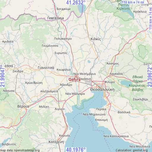
Géfyra GPS coordinates[2]
40° 43' 57.108" North, 22° 41' 36.924" East
| Map corner | latitude | longitude |
|---|---|---|
| Upper-left | 41.2632°, | 21.99047° |
| Center: | 40.73253°, | 22.69359° |
| Lower-right: | 40.1976°, | 23.39672° |
| Map W x H: | 118.5×118.5 km | = 73.6×73.6mi |
| max Lat: | 41.72048° ⇑17.5% North |
| Géfyra: | 40.73253° |
| min Lat: | ⇓82.5% South 34.8346° |
| min Long | Géfyra | max Long |
| 19.40494° | 22.69359° | 29.59361° |
| W 44.6%⇐ | ⇒55.4% E |
Elevation
Elevation of Géfyra is 32 m = 105 ft, and this is 136.9 m = 449 ft below average elevation for this country.
| Max E: |
1439 m = 4721 ft | 69.6% |
| Avg. | 168.9 m = 554 ft | |
| Géfyra | 32 m = 105 ft | |
Min E: |
0 m = 0 ft | 30.4% |
See also: Greece elevation on elevation.city.
Geographical zone
Géfyra is located in North temperate zone (between Tropic of Cancer and the Arctic Circle). Distance of this Northern Tropic circle is 1923.1 km =1195 mi to South.| Distance of | km | miles | from Géfyra |
|---|---|---|---|
| North Pole | 5478 | 3403.9 | to North |
| Arctic Circle | 2872.1 | 1784.6 | to North |
| Tropic Cancer | 1923.1 | 1195 | to South |
| Equator | 4529 | 2814.2 | to South |


Nearby cities:
15 places around Géfyra: (largest is in red/bold)
• Anatolikó
8 km =5 mi,  168°
168°
• Anchíalos
7.5 km =4.7 mi,  104°
104°
• Chalkidóna
7.9 km =4.9 mi,  269°
269°
• Eleoúsa
5.9 km =3.7 mi,  287°
287°
• Kastanás
10.1 km =6.3 mi,  343°
343°
• Néa Mesimvría
6.7 km =4.2 mi,  71°
71°
• Néo Agionéri
8.5 km =5.3 mi,  7°
7°
• Palaió Agionéri
9.6 km =6 mi,  17°
17°
• Parthéni
8.1 km =5 mi,  243°
243°
• Próchoma
7.7 km =4.8 mi, 342°
• Vathýlakkos
4.3 km =2.7 mi, 17°
• Vrachiá
9 km =5.6 mi,  209°
209°
• Xirochóri
10.6 km =6.6 mi,  42°
42°
• Ádendro
10.1 km =6.3 mi,  227°
227°
• Ágios Athanásios
3.5 km =2.2 mi,  122°
122°
Sources, notices
• [Note1] Compared only with cities in Greece existing in our database
• [Src1] Map data: © OpenStreetMap contributors (CC-BY-SA)
• [Src2] Other city data from geonames.org with taken over terms of usage.
• [Src3] Geographical zone / Annual Mean Temperature by Robert A. Rohde @ Wikipedia
