Próchoma geodata
Próchoma (Central Macedonia) is a populated place; located in Greece in Europe/Athens (GMT+3) time zone. With population of 1,422 people, there are 710 cities with bigger population in this country. Compared to other cities in Greece, 85.3% of cities are located further ↓South; 55.8% of cities are located further →East and 51.6% of cities have lower elevation than Próchoma. Note1
Administrative division(s):
- Level 1: Central Macedonia
- Level 2: Nomós Thessaloníkis
- Level 3: Dimos Chalkidona


Próchoma GPS coordinates[2]
40° 47' 53.736" North, 22° 39' 59.724" East
| Map corner | latitude | longitude |
|---|---|---|
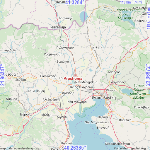
| Upper-left | 41.3284°, | 21.96347° |
| Center: | 40.79826°, | 22.66659° |
| Lower-right: | 40.26385°, | 23.36972° |
| Map W x H: | 118.4×118.4 km | = 73.6×73.6mi |
| max Lat: | 41.72048° ⇑14.7% North |
| Próchoma: | 40.79826° |
| min Lat: | ⇓85.3% South 34.8346° |
| min Long | Próchoma | max Long |
| 19.40494° | 22.66659° | 29.59361° |
| W 44.2%⇐ | ⇒55.8% E |
Elevation
Elevation of Próchoma is 87 m = 285 ft, and this is 81.9 m = 269 ft below average elevation for this country.
| Max E: |
1439 m = 4721 ft | 48.4% |
| Avg. | 168.9 m = 554 ft | |
| Próchoma | 87 m = 285 ft | |
Min E: |
0 m = 0 ft | 51.6% |
See also: Greece elevation on elevation.city.
Geographical zone
Próchoma is located in North temperate zone (between Tropic of Cancer and the Arctic Circle). Distance of this Northern Tropic circle is 1930.4 km =1199.5 mi to South.| Distance of | km | miles | from Próchoma |
|---|---|---|---|
| North Pole | 5470.7 | 3399.3 | to North |
| Arctic Circle | 2864.8 | 1780.1 | to North |
| Tropic Cancer | 1930.4 | 1199.5 | to South |
| Equator | 4536.3 | 2818.7 | to South |


Nearby cities:
15 places around Próchoma: (largest is in red/bold)
• Akropótamos
4.8 km =3 mi,  347°
347°
• Chalkidóna
9.3 km =5.8 mi,  217°
217°
• Eleoúsa
6.5 km =4 mi,  211°
211°
• Géfyra
7.7 km =4.8 mi,  162°
162°
• Kastanás
2.4 km =1.5 mi,  344°
344°
• Koufália
8.3 km =5.2 mi,  254°
254°
• Mikrókampos
10.3 km =6.4 mi,  62°
62°
• Néa Mesimvría
10.1 km =6.3 mi,  121°
121°
• Néo Agionéri
3.6 km =2.2 mi,  72°
72°
• Palaió Agionéri
5.4 km =3.4 mi, 70°
• Vathýlakkos
4.8 km =3 mi,  132°
132°
• Xirochóri
9.5 km =5.9 mi,  86°
86°
• Ágios Athanásios
10.5 km =6.5 mi,  150°
150°
• Ágios Pétros
10.4 km =6.5 mi,  317°
317°
• Áthyra
6.9 km =4.3 mi,  296°
296°
Sources, notices
• [Note1] Compared only with cities in Greece existing in our database
• [Src1] Map data: © OpenStreetMap contributors (CC-BY-SA)
• [Src2] Other city data from geonames.org with taken over terms of usage.
• [Src3] Geographical zone / Annual Mean Temperature by Robert A. Rohde @ Wikipedia
