Stratoníki geodata
Stratoníki (Central Macedonia) is a populated place; located in Greece in Europe/Athens (GMT+3) time zone. With population of 561 people, there are 1674 cities with bigger population in this country. Compared to other cities in Greece, 75.6% of cities are located further ↓South; 71.8% of cities are located further ←West and 88% of cities have lower elevation than Stratoníki. Note1
Administrative division(s):
- Level 1: Central Macedonia
- Level 2: Nomós Chalkidikís
- Level 3: Dimos Aristotelis


Stratoníki GPS coordinates[2]
40° 31' 39.792" North, 23° 45' 47.016" East
| Map corner | latitude | longitude |
|---|---|---|
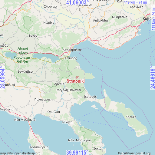
| Upper-left | 41.06003°, | 23.05994° |
| Center: | 40.52772°, | 23.76306° |
| Lower-right: | 39.99115°, | 24.46619° |
| Map W x H: | 118.8×118.8 km | = 73.8×73.8mi |
| max Lat: | 41.72048° ⇑24.4% North |
| Stratoníki: | 40.52772° |
| min Lat: | ⇓75.6% South 34.8346° |
| min Long | Stratoníki | max Long |
| 19.40494° | 23.76306° | 29.59361° |
| W 71.8%⇐ | ⇒28.2% E |
Elevation
Elevation of Stratoníki is 460 m = 1509 ft, and this is 291.1 m = 955 ft above average elevation for this country.
| Max E: |
1439 m = 4721 ft | 12% |
| Stratoníki | 460 m 1509 ft | |
| Avg. | 168.9 m = 554 ft | |
Min E: |
0 m = 0 ft | 88% |
See also: Greece elevation on elevation.city.
Geographical zone
Stratoníki is located in North temperate zone (between Tropic of Cancer and the Arctic Circle). Distance of this Northern Tropic circle is 1900.3 km =1180.8 mi to South.| Distance of | km | miles | from Stratoníki |
|---|---|---|---|
| North Pole | 5500.8 | 3418 | to North |
| Arctic Circle | 2894.9 | 1798.8 | to North |
| Tropic Cancer | 1900.3 | 1180.8 | to South |
| Equator | 4506.3 | 2800.1 | to South |


Nearby cities:
15 places around Stratoníki: (largest is in red/bold)
• Arnaía
14.9 km =9.3 mi,  252°
252°
• Asproválta
23 km =14.3 mi,  349°
349°
• Gomáti
14.9 km =9.3 mi,  169°
169°
• Ierissós
17.3 km =10.7 mi,  146°
146°
• Megáli Panagía
11.6 km =7.2 mi,  217°
217°
• Neochóri
7.4 km =4.6 mi, 253°
• Néa Róda
21.2 km =13.2 mi,  140°
140°
• Néa Vrasná
20.5 km =12.7 mi,  344°
344°
• Olympiáda
7.3 km =4.5 mi,  12°
12°
• Palaiochóri
10.4 km =6.5 mi, 247°
• Stanós
14.8 km =9.2 mi,  277°
277°
• Stavrós
16.2 km =10.1 mi, 340°
• Stratónion
5.4 km =3.4 mi,  106°
106°
• Taxiárchis
23.4 km =14.5 mi,  240°
240°
• Varvára
10 km =6.2 mi,  297°
297°
Sources, notices
• [Note1] Compared only with cities in Greece existing in our database
• [Src1] Map data: © OpenStreetMap contributors (CC-BY-SA)
• [Src2] Other city data from geonames.org with taken over terms of usage.
• [Src3] Geographical zone / Annual Mean Temperature by Robert A. Rohde @ Wikipedia
