Arnaía geodata
Arnaía (Central Macedonia) is a populated place; located in Greece in Europe/Athens (GMT+3) time zone. With population of 2,300 people, there are 451 cities with bigger population in this country. Compared to other cities in Greece, 74% of cities are located further ↓South; 66.5% of cities are located further ←West and 92.9% of cities have lower elevation than Arnaía. Note1
Administrative division(s):
- Level 1: Central Macedonia
- Level 2: Nomós Chalkidikís
- Level 3: Dimos Aristotelis


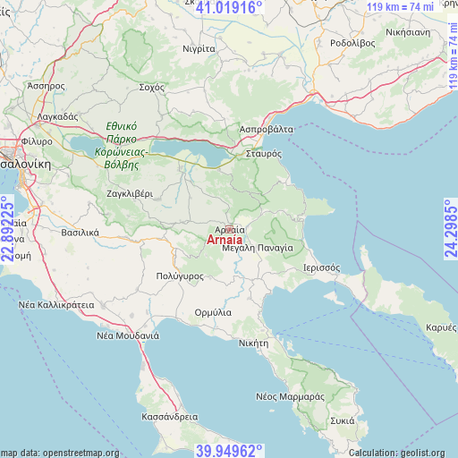
Arnaía GPS coordinates[2]
40° 29' 11.472" North, 23° 35' 43.332" East
| Map corner | latitude | longitude |
|---|---|---|
| Upper-left | 41.01916°, | 22.89225° |
| Center: | 40.48652°, | 23.59537° |
| Lower-right: | 39.94962°, | 24.2985° |
| Map W x H: | 118.9×118.9 km | = 73.9×73.9mi |
| max Lat: | 41.72048° ⇑26% North |
| Arnaía: | 40.48652° |
| min Lat: | ⇓74% South 34.8346° |
| min Long | Arnaía | max Long |
| 19.40494° | 23.59537° | 29.59361° |
| W 66.5%⇐ | ⇒33.5% E |
Elevation
Elevation of Arnaía is 605 m = 1985 ft, and this is 436.1 m = 1431 ft above average elevation for this country.
| Max E: |
1439 m = 4721 ft | 7.1% |
| Arnaía | 605 m 1985 ft | |
| Avg. | 168.9 m = 554 ft | |
Min E: |
0 m = 0 ft | 92.9% |
See also: Greece elevation on elevation.city.
Geographical zone
Arnaía is located in North temperate zone (between Tropic of Cancer and the Arctic Circle). Distance of this Northern Tropic circle is 1895.8 km =1178 mi to South.| Distance of | km | miles | from Arnaía |
|---|---|---|---|
| North Pole | 5505.4 | 3420.9 | to North |
| Arctic Circle | 2899.5 | 1801.7 | to North |
| Tropic Cancer | 1895.8 | 1178 | to South |
| Equator | 4501.7 | 2797.2 | to South |


Nearby cities:
15 places around Arnaía: (largest is in red/bold)
• Gomáti
19.7 km =12.2 mi,  120°
120°
• Megáli Panagía
8.5 km =5.3 mi, 122°
• Metagkítsi
18.7 km =11.6 mi,  164°
164°
• Neochóri
7.5 km =4.7 mi,  70°
70°
• Néa Apollonía
20.2 km =12.6 mi,  319°
319°
• Olympiáda
19.7 km =12.2 mi,  53°
53°
• Palaiochóra
12.3 km =7.6 mi,  277°
277°
• Palaiochóri
4.6 km =2.9 mi,  82°
82°
• Polýgyros
17.8 km =11.1 mi,  226°
226°
• Stanós
6.5 km =4 mi,  355°
355°
• Stratoníki
14.9 km =9.3 mi, 72°
• Stratónion
19.6 km =12.2 mi, 81°
• Taxiárchis
9.2 km =5.7 mi,  222°
222°
• Varvára
10.7 km =6.6 mi,  30°
30°
• Vrástama
13.7 km =8.5 mi,  201°
201°
Sources, notices
• [Note1] Compared only with cities in Greece existing in our database
• [Src1] Map data: © OpenStreetMap contributors (CC-BY-SA)
• [Src2] Other city data from geonames.org with taken over terms of usage.
• [Src3] Geographical zone / Annual Mean Temperature by Robert A. Rohde @ Wikipedia
